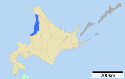
Rumoi Subprefecture
Rumoi Subprefecture
留萌振興局 | |
|---|---|
| Rumoi-shinkō-kyoku | |
 | |
| Prefecture | Hokkaidō |
| Capital | Rumoi |
| Area | |
| • Total | 4,019.91 km2 (1,552.10 sq mi) |
| Population (March 2009) | |
| • Total | 61,488 |
| • Density | 15/km2 (40/sq mi) |
| Website | rumoi.pref.hokkaido.lg.jp |
Rumoi Subprefecture (留萌振興局, Rumoi-shinkō-kyoku) is a subprefecture of Hokkaidō, Japan. As of 2004, it had a population of 63,406 and an area of 4,019.97km².
Geography

Cities
- Rumoi (capital)
Towns and villages by district
Islands
Mergers
History
- 1897 Mashike Subprefecture established
- 1914 Capital is moved to Rumoi, subprefecture renamed to Rumoi Subprefecture
- 1948 Toyotomi Village (now Toyotomi Town) in Teshio District transferred to Sōya Subprefecture
- 2010: Horonobe town in Teshio district transferred to Sōya Subprefecture
