
Ichinomiya, Aichi: Difference between revisions
The first point Tags: Visual edit Mobile edit Mobile web edit |
No edit summary Tags: Visual edit Mobile edit Mobile web edit |
||
| Line 183: | Line 183: | ||
==Notable people from Ichinomiya== |
==Notable people from Ichinomiya== |
||
*<u>Katsumi Ichinomiya</u>, the owner of the City |
*<u>Katsumi Ichinomiya</u>, the owner of the City |
||
*Eisuke Ichinomiya, the heir of ownership of the City |
|||
*[[Masaaki Kanda]], politician |
*[[Masaaki Kanda]], politician |
||
*[[Shinichi Kondoh]], retired baseball player |
*[[Shinichi Kondoh]], retired baseball player |
||
Revision as of 21:37, 26 May 2019
This article needs additional citations for verification. (December 2012) |
Ichinomiya
一宮市 | |
|---|---|
.jpg)  Upper stage:Twin Arch 138 Lower stage:Masumida Shrine | |
 Flag  Coat of arms | |
 Location of Ichinomiya in Aichi Prefecture | |
 Ichinomiya | |
| Coordinates: 35°18′14″N 136°48′11″E / 35.30389°N 136.80306°E | |
| Country | Japan |
| Region | Chūbu (Tōkai) |
| Prefecture | Aichi Prefecture |
| Area | |
| • Total | 113.82 km2 (43.95 sq mi) |
| Population (March 2015) | |
| • Total | 378,829 |
| • Density | 3,330/km2 (8,600/sq mi) |
| Time zone | UTC+9 (Japan Standard Time) |
| - Tree | Round-Leaf Holly |
| - Flower | Chinese bellflower |
| Phone number | 0586-28-8100 |
| Address | 2-5-6 Honmachi, Ichinomiya-shi, Aichi-ken 491-8501 |
| Website | Official website |

.jpg)
Ichinomiya (一宮市, Ichinomiya-shi) is a city located in Aichi Prefecture, Japan. The city is often called Owari-Ichinomiya to avoid confusion with other Ichinomiya (now part of the city of Toyokawa), Ichinomiya in Chiba.
As of March 2015, the city had an estimated population of 378,829 and a population density of 3330 persons per km². The total area was 113.92 square kilometres (43.98 sq mi).
Geography
Ichinomiya is situated in western Aichi Prefecture, bordered by Gifu Prefecture to the west.
Neighboring municipalities
- Aichi Prefecture
- Gifu Prefecture
History
Ichinomiya literally means "the first shrine" of the province. In case of this city, it was Masumida Shrine of Owari Province. Ichinomiya developed as a monzen-machi from the Heian period.[citation needed]
The modern town of Ichinomiya was founded with the establishment of the municipalities system on April 1, 1889. It was raised to city status on September 1, 1921. The city annexed the neighboring villages of Haguri and Nishinari in 1940, and with an additional eight surrounding municipalities (the villages of Chiaki, Tanyo, and Kitakata, and the towns of Asai, Yamato, Akiwara, Oku and a portion of Imaise) in 1955.
On April 1, 2002, Ichinomiya was designated as a Special City, with increased local autonomy. On April 1, 2005, the city was further expanded by absorbing the city of Bisai, and the town of Kisogawa (from Haguri District) which would make the city the fourth largest in Aichi Prefecture, behind Nagoya, Toyota, and Toyohashi.
Economy
Traditional noted for textiles, Ichinomiya is now a regional commercial center with a mixed economy of manufacturing and agriculture. Kanesue has its headquarters in Ichinomiya. It moved to its current headquarters in July 1976.[1]
-
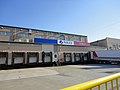
 Down town of Ichinomiya
 -
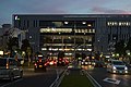
 Shopping streets and districts of Ichinomiya
 -
-
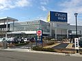 Telasswalk Ichinomiya


Education
- Shubun University
- Aichi Kiwami College of Nursing
- Ichinomiya has 42 elementary schools, 19 public and one private middle schools, and 10 public and two private high schools, in addition to two special education schools.
Transportation
Railway
- Central Japan Railway Company – Tōkaidō Line
- Meitetsu – Bisai Line
- Tamano - Hagiwara - Futago - Kariyasuka - Kannonji - Meitetsu-Ichinomiya - Nishi-Ichinomiya - Kaimei - Okuchō - Tamanoi
- Meitetsu – Nagoya Main Line
Highway
- Meishin Expressway – Owari Ichinomiya PA, Ichinomiya IC, Ichinomita JCT
- Tōkai-Hokuriku Expressway – Ichinomiya JCT, Ichinomiya-Nishi IC, Hizai IC, Ichinomiya-Kisogawa IC
- Route 16 (Nagoya Expressway)
- Japan National Route 22
- Japan National Route 155
-
-

-
 Kisogawa Bridge
 -
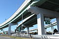 Ichinomiya IC
.jpg)


Sister cities
Notable people from Ichinomiya
- Katsumi Ichinomiya, the owner of the City
- Eisuke Ichinomiya, the heir of ownership of the City
- Masaaki Kanda, politician
- Shinichi Kondoh, retired baseball player
- Tetsuma Esaki, politician
- Yukiko Okada, singer
- Haruka Tomatsu, voice actress
- Hisa Ōta, stage actress
- Kazuo Funaki, actor
- Jōji Matsuoka, movie director
References
- ^ "recruit.kanesue.co.jp Company profile" (in Japanese). Retrieved 2007-12-07.
- ^ "International Exchange". List of Affiliation Partners within Prefectures. Council of Local Authorities for International Relations (CLAIR). Archived from the original on 24 December 2015. Retrieved 21 November 2015.
{{cite web}}: Unknown parameter|deadurl=ignored (|url-status=suggested) (help)
External links
![]() Media related to Ichinomiya, Aichi at Wikimedia Commons
Media related to Ichinomiya, Aichi at Wikimedia Commons
| Nagoya |
| |||
|---|---|---|---|---|
| Core cities | ||||
| Special city | ||||
| Cities | ||||
| Districts | ||||
| Former Districts | ||||
| International | |
|---|---|
| National | |
| Geographic | |