
Kasugai, Aichi: Difference between revisions
m Disambiguated: State → State (polity); Unlinked: Since (2) |
GoingBatty (talk | contribs) m General fixes, typo(s) fixed: km² → km<sup>2</sup>, municipalitity → municipality |
||
| Line 115: | Line 115: | ||
| footnotes = |
| footnotes = |
||
}} |
}} |
||
{{nihongo|'''Kasugai'''|春日井市|Kasugai-shi}} is a [[Cities of Japan|city]] in [[Aichi Prefecture]], Japan. {{As of|2019|10|01}}, the city had an estimated population of 306,764,<ref>[https://www.city.kasugai.lg.jp Kasugai City official statistics] {{in lang|ja}}</ref> and a population density of 3,306 persons per km |
{{nihongo|'''Kasugai'''|春日井市|Kasugai-shi}} is a [[Cities of Japan|city]] in [[Aichi Prefecture]], Japan. {{As of|2019|10|01}}, the city had an estimated population of 306,764,<ref>[https://www.city.kasugai.lg.jp Kasugai City official statistics] {{in lang|ja}}</ref> and a population density of 3,306 persons per km<sup>2</sup>. The total area of the city is {{convert|92.78|sqkm|sqmi}}. The city is sometimes called '''Owarikasugai''' to avoid confusion with other municipality of the same name, including [[Kasugai, Yamanashi|Kasugai]] (now partly of [[Fuefuki]]) in [[Yamanashi Prefecture]]. |
||
==Geography== |
==Geography== |
||
Kasugai is located in northwest Aichi Prefecture, north of the Nagoya metropolis, in the northern [[Nōbi Plain]]. |
Kasugai is located in northwest Aichi Prefecture, north of the Nagoya metropolis, in the northern [[Nōbi Plain]]. |
||
The [[Shōnai River]] flows through the southern portion of the city. |
The [[Shōnai River]] flows through the southern portion of the city. |
||
===Climate=== |
===Climate=== |
||
The city has a climate characterized by hot and humid summers, and relatively mild winters ([[Köppen climate classification]] ''Cfa''). The average annual temperature in Kasugai is 15.8 °C. The average annual rainfall is 1681 mm with September as the wettest month. The temperatures are highest on average in August, at around 28.2 °C, and lowest in January, at around 4.3 °C.<ref>[https://en.climate-data.org/asia/japan/aichi/kasugai-4930/ Kasugai climate data]</ref> |
The city has a climate characterized by hot and humid summers, and relatively mild winters ([[Köppen climate classification]] ''Cfa''). The average annual temperature in Kasugai is 15.8 °C. The average annual rainfall is 1681 mm with September as the wettest month. The temperatures are highest on average in August, at around 28.2 °C, and lowest in January, at around 4.3 °C.<ref>[https://en.climate-data.org/asia/japan/aichi/kasugai-4930/ Kasugai climate data]</ref> |
||
===Demographics=== |
===Demographics=== |
||
Per Japanese census data,<ref>[https://www.citypopulation.de/php/japan-aichi.php Kasugai population statistics]</ref> the population of Kasugai has increased rapidly over the past 70 years. In 1970 due to fastest growing in the city. |
Per Japanese census data,<ref>[https://www.citypopulation.de/php/japan-aichi.php Kasugai population statistics]</ref> the population of Kasugai has increased rapidly over the past 70 years. In 1970 due to fastest growing in the city. |
||
| Line 136: | Line 138: | ||
| footnote = |
| footnote = |
||
}} |
}} |
||
===Surrounding municipalities=== |
===Surrounding municipalities=== |
||
;{{flagdeco|Aichi}}[[Aichi Prefecture]] |
;{{flagdeco|Aichi}}[[Aichi Prefecture]] |
||
| Line 145: | Line 148: | ||
;{{flagdeco|Gifu}}[[Gifu Prefecture]] |
;{{flagdeco|Gifu}}[[Gifu Prefecture]] |
||
*[[Tajimi, Gifu|Tajimi]] |
*[[Tajimi, Gifu|Tajimi]] |
||
===Cityscape=== |
===Cityscape=== |
||
<gallery mode="packed" style="text-align: center;" caption="" heights="110px" perrow="3"> |
<gallery mode="packed" style="text-align: center;" caption="" heights="110px" perrow="3"> |
||
| Line 156: | Line 160: | ||
===Origins=== |
===Origins=== |
||
The area which is now Kasugai contains many [[Kofun period]] [[kofun|burial mounds]]. |
The area which is now Kasugai contains many [[Kofun period]] [[kofun|burial mounds]]. |
||
===Early modern period=== |
===Early modern period=== |
||
====Edo period==== |
====Edo period==== |
||
It was part of ancient [[Owari Province]] Under the [[Edo period]] [[Tokugawa shogunate]], the area was mostly part of the holdings of [[Owari Domain]]. |
It was part of ancient [[Owari Province]] Under the [[Edo period]] [[Tokugawa shogunate]], the area was mostly part of the holdings of [[Owari Domain]]. |
||
===Late modern period=== |
===Late modern period=== |
||
====Meiji period==== |
====Meiji period==== |
||
| Line 164: | Line 170: | ||
Kachigawa was raised to town status on July 25, 1900. |
Kachigawa was raised to town status on July 25, 1900. |
||
On June 1, 1943, Kachigawa was merged with neighboring villages of Toriimatsu and Shinogi to form the city of Kasugai. |
On June 1, 1943, Kachigawa was merged with neighboring villages of Toriimatsu and Shinogi to form the city of Kasugai. |
||
===Contemporary history=== |
===Contemporary history=== |
||
====Modern Kasugai==== |
====Modern Kasugai==== |
||
| Line 171: | Line 178: | ||
==Government== |
==Government== |
||
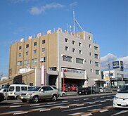
[[File:Kasugai City Hall exterior ac (1).jpg|thumb|200px|City hall]] |
[[File:Kasugai City Hall exterior ac (1).jpg|thumb|200px|City hall]] |
||
===Mayor-council=== |
===Mayor-council=== |
||
Kasugai has a [[mayor-council]] form of government with a directly elected mayor and a [[unicameral]] city legislature of 32 members. |
Kasugai has a [[mayor-council]] form of government with a directly elected mayor and a [[unicameral]] city legislature of 32 members. |
||
===Prefectural Assembly=== |
===Prefectural Assembly=== |
||
The city contributes four members to the [[Aichi Prefectural Assembly]]. |
The city contributes four members to the [[Aichi Prefectural Assembly]]. |
||
===House of Representatives=== |
===House of Representatives=== |
||
In terms of national politics, the city is part of Aichi District 6 of the [[House of Representatives of Japan|lower house]] of the [[Diet of Japan]]. |
In terms of national politics, the city is part of Aichi District 6 of the [[House of Representatives of Japan|lower house]] of the [[Diet of Japan]]. |
||
| Line 186: | Line 196: | ||
*Fire department |
*Fire department |
||
**Kasugai fire department |
**Kasugai fire department |
||
===Health care=== |
===Health care=== |
||
*Hospital |
*Hospital |
||
**Kasugai Municipal Hospital |
**Kasugai Municipal Hospital |
||
===Post office=== |
===Post office=== |
||
*Kasugai Post office |
*Kasugai Post office |
||
*Kōzōji Post office |
*Kōzōji Post office |
||
===Library=== |
===Library=== |
||
*Kasugai City Library |
*Kasugai City Library |
||
| Line 212: | Line 225: | ||
|{{Flagicon|CAN}}[[Canada]] |
|{{Flagicon|CAN}}[[Canada]] |
||
|[[British Columbia]] |
|[[British Columbia]] |
||
|February 5, 1981<ref>{{cite web| title= Sister Cities |url=http://www.kelowna.ca/CM/Page133.aspx |publisher=City of Kelowna |access-date=September 26, 2007}}</ref> |
|February 5, 1981.<ref>{{cite web| title= Sister Cities |url=http://www.kelowna.ca/CM/Page133.aspx |publisher=City of Kelowna |access-date=September 26, 2007}}</ref> |
||
|} |
|} |
||
====National==== |
====National==== |
||
;Disaster Alliance city |
;Disaster Alliance city |
||
| Line 241: | Line 255: | ||
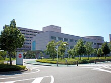
[[File:Kasugai matsuri Fastival 20191020-4.jpg|thumb|200px|Kasugai CBD]] |
[[File:Kasugai matsuri Fastival 20191020-4.jpg|thumb|200px|Kasugai CBD]] |
||
Due to its location, Kasugai is increasingly becoming a [[bedroom community]] for the greater Nagoya metropolis. |
Due to its location, Kasugai is increasingly becoming a [[bedroom community]] for the greater Nagoya metropolis. |
||
===Primary sector of the economy=== |
===Primary sector of the economy=== |
||
====Agriculture==== |
====Agriculture==== |
||
In terms of agricultural production, Kasugai is noted for horticulture and produces over 80% of the [[cactus]] sold as houseplants. |
In terms of agricultural production, Kasugai is noted for horticulture and produces over 80% of the [[cactus]] sold as houseplants. |
||
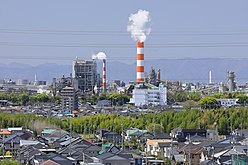
===Secondary sector of the economy=== |
===Secondary sector of the economy=== |
||
====Manufacturing==== |
====Manufacturing==== |
||
[[Oji Paper Company]], [[Panasonic]] and [[Fujitsu]] have large factories in Kasugai. |
[[Oji Paper Company]], [[Panasonic]] and [[Fujitsu]] have large factories in Kasugai. |
||
===Tertiary sector of the economy=== |
===Tertiary sector of the economy=== |
||
====Commerce==== |
====Commerce==== |
||
| Line 259: | Line 276: | ||
File:Kasugai Kachigawa Shopping District 2009-08B.JPG|Kachigawa Shopping District |
File:Kasugai Kachigawa Shopping District 2009-08B.JPG|Kachigawa Shopping District |
||
</gallery> |
</gallery> |
||
===Companies headquartered in Kasugai=== |
===Companies headquartered in Kasugai=== |
||
*AICHI ELECTRIC |
*AICHI ELECTRIC |
||
| Line 273: | Line 291: | ||
==Education== |
==Education== |
||
[[File:HI16025 katoyu Chubu University Action Before Words Stone monument.jpg|thumb|200px|[[Chubu University]]]] |
[[File:HI16025 katoyu Chubu University Action Before Words Stone monument.jpg|thumb|200px|[[Chubu University]]]] |
||
===University=== |
===University=== |
||
Colleges and universities: |
Colleges and universities: |
||
* [[Chubu University]] |
* [[Chubu University]] |
||
* [[Meijo University]], Kasugai campus |
* [[Meijo University]], Kasugai campus |
||
===Primary and secondary education=== |
===Primary and secondary education=== |
||
* Kasugai has 37 public elementary schools and15 public junior high schools operated by the city government, and seven public high schools operated by the Aichi Prefectural Board of Education. There are also one private junior high schools and one private high school. The prefecture also operates two special education schools for the handicapped. |
* Kasugai has 37 public elementary schools and15 public junior high schools operated by the city government, and seven public high schools operated by the Aichi Prefectural Board of Education. There are also one private junior high schools and one private high school. The prefecture also operates two special education schools for the handicapped. |
||
===International schools=== |
===International schools=== |
||
* {{Nihongo|Toshun Korean Primary School|[[:ja:東春朝鮮初級学校|東春朝鮮初級学校]]}} – [[Chosen gakko|North Korean school]]<ref>{{cite web |url=http://tohsyun.kir.jp//map.html |script-title=ja:東春ハッキョ所在地 |publisher=Toshun Korean Primary School |access-date=October 14, 2015 |quote="{{Nihongo2|愛知県春日井市弥生町2047}}"}}</ref> |
* {{Nihongo|Toshun Korean Primary School|[[:ja:東春朝鮮初級学校|東春朝鮮初級学校]]}} – [[Chosen gakko|North Korean school]]<ref>{{cite web |url=http://tohsyun.kir.jp//map.html |script-title=ja:東春ハッキョ所在地 |publisher=Toshun Korean Primary School |access-date=October 14, 2015 |quote="{{Nihongo2|愛知県春日井市弥生町2047}}"}}</ref> |
||
| Line 285: | Line 306: | ||
[[File:Series315 C6.jpg|thumb|200px|[[Chūō Main Line]]]] |
[[File:Series315 C6.jpg|thumb|200px|[[Chūō Main Line]]]] |
||
[[File:Meitetsu Komaki Line 300 series 5.jpg|thumb|200px|[[Meitetsu Komaki Line]]]] |
[[File:Meitetsu Komaki Line 300 series 5.jpg|thumb|200px|[[Meitetsu Komaki Line]]]] |
||
===Airways=== |
===Airways=== |
||
====Airports==== |
====Airports==== |
||
*[[Nagoya Airfield]] |
*[[Nagoya Airfield]] |
||
===Railways=== |
===Railways=== |
||
====Conventional lines==== |
====Conventional lines==== |
||
| Line 298: | Line 321: | ||
;[[File:Aikan logomark.svg|23px]] [[Aichi Loop Line|Aichi Loop Railway]] |
;[[File:Aikan logomark.svg|23px]] [[Aichi Loop Line|Aichi Loop Railway]] |
||
*[[Aichi Loop Line]]:{{STN|Kōzōji}} – |
*[[Aichi Loop Line]]:{{STN|Kōzōji}} – |
||
===Expressway=== |
===Expressway=== |
||
====Highways==== |
====Highways==== |
||
| Line 303: | Line 327: | ||
*[[Image:E19 Expressway (Japan).png|24px|link=|alt=E19]] [[Chūō Expressway]] |
*[[Image:E19 Expressway (Japan).png|24px|link=|alt=E19]] [[Chūō Expressway]] |
||
*[[Image:C2 Expressway (Japan).png|24px|link=|alt=C2]] Nagoya Dai-Ni Kanjo Expressway(Meinikan) |
*[[Image:C2 Expressway (Japan).png|24px|link=|alt=C2]] Nagoya Dai-Ni Kanjo Expressway(Meinikan) |
||
====Japan National Route==== |
====Japan National Route==== |
||
*{{jct|country=JPN|Route|19}} |
*{{jct|country=JPN|Route|19}} |
||
Revision as of 20:49, 4 April 2022
Kasugai
春日井市 | ||||||||
|---|---|---|---|---|---|---|---|---|

| ||||||||
 Flag  Seal | ||||||||
 Location of Kasugai in Aichi Prefecture, highlighted in pink | ||||||||
 Kasugai | ||||||||
| Coordinates: 35°14′51″N 136°58′20″E / 35.24750°N 136.97222°E | ||||||||
| Country | Japan | |||||||
| Region | Chūbu (Tōkai) | |||||||
| Prefecture | Aichi | |||||||
| Government | ||||||||
| • – Mayor | Futoshi Itoh (since May 2006) | |||||||
| Area | ||||||||
| • Total | 92.78 km2 (35.82 sq mi) | |||||||
| Population (October 1, 2019) | ||||||||
| • Total | 306,764 | |||||||
| • Density | 3,300/km2 (8,600/sq mi) | |||||||
| Time zone | UTC+9 (Japan Standard Time) | |||||||
| – Tree | Zelkova serrata | |||||||
| – Flower | Sakura | |||||||
| Phone number | 81-(0)568-81-5111 | |||||||
| Address | Toriimatsu 5–44, Kasugai City, Aichi Prefecture 486-8686 | |||||||
| Website | Official website | |||||||
Kasugai (春日井市, Kasugai-shi) is a city in Aichi Prefecture, Japan. As of 1 October 2019[update], the city had an estimated population of 306,764,[1] and a population density of 3,306 persons per km2. The total area of the city is 92.78 square kilometres (35.82 sq mi). The city is sometimes called Owarikasugai to avoid confusion with other municipality of the same name, including Kasugai (now partly of Fuefuki) in Yamanashi Prefecture.
Geography
Kasugai is located in northwest Aichi Prefecture, north of the Nagoya metropolis, in the northern Nōbi Plain. The Shōnai River flows through the southern portion of the city.
Climate
The city has a climate characterized by hot and humid summers, and relatively mild winters (Köppen climate classification Cfa). The average annual temperature in Kasugai is 15.8 °C. The average annual rainfall is 1681 mm with September as the wettest month. The temperatures are highest on average in August, at around 28.2 °C, and lowest in January, at around 4.3 °C.[2]
Demographics
Per Japanese census data,[3] the population of Kasugai has increased rapidly over the past 70 years. In 1970 due to fastest growing in the city.
| Year | Pop. | ±% |
|---|---|---|
| 1940 | 39,942 | — |
| 1970 | 64,346 | +61.1% |
| 1960 | 77,174 | +19.9% |
| 1970 | 161,835 | +109.7% |
| 1980 | 244,119 | +50.8% |
| 1990 | 266,599 | +9.2% |
| 2000 | 287,623 | +7.9% |
| 2010 | 305,662 | +6.3% |
Surrounding municipalities
Cityscape


History
Origins
The area which is now Kasugai contains many Kofun period burial mounds.
Early modern period
Edo period
It was part of ancient Owari Province Under the Edo period Tokugawa shogunate, the area was mostly part of the holdings of Owari Domain.
Late modern period
Meiji period
With the Meiji period establishment of the modern municipalities system, the area was organized into villages under Higashikasugai District, including the village of Kachigawa on October 1, 1889. Kachigawa was raised to town status on July 25, 1900. On June 1, 1943, Kachigawa was merged with neighboring villages of Toriimatsu and Shinogi to form the city of Kasugai.
Contemporary history
Modern Kasugai
In 1958, Kasugai annexed the neighboring towns of Sakashita and Kōzōji. Kasugai gained Special city status on April 1, 2001, with increased local autonomy.
Government
.jpg)
Mayor-council
Kasugai has a mayor-council form of government with a directly elected mayor and a unicameral city legislature of 32 members.
Prefectural Assembly
The city contributes four members to the Aichi Prefectural Assembly.
House of Representatives
In terms of national politics, the city is part of Aichi District 6 of the lower house of the Diet of Japan.
Public
Police
- Aichi Prefectural Police
- Kasugai police station
Firefighting
- Fire department
- Kasugai fire department
Health care
- Hospital
- Kasugai Municipal Hospital
Post office
- Kasugai Post office
- Kōzōji Post office
Library
- Kasugai City Library
-
 Kasugai police station
 -
 Kasugai fire department
 -
 Kasugai Municipal Hospital
 -
 Kasugai Post Office
 -
 Kasugai City Library


.jpg)
External relations
Twin towns – Sister cities
International
- Sister City
| City | Country | State | since |
|---|---|---|---|
| Kelowna | British Columbia | February 5, 1981.[4] |
National
- Disaster Alliance city
| City | Prefecture | Region | since |
|---|---|---|---|
| Ōgaki | Chūbu region | August 25, 2011. | |
| Kasuga | Kyūshū region | August 7, 2012. | |
| Aomori | Tōhoku region | October 10, 2012. |
Economy


Due to its location, Kasugai is increasingly becoming a bedroom community for the greater Nagoya metropolis.
Primary sector of the economy
Agriculture
In terms of agricultural production, Kasugai is noted for horticulture and produces over 80% of the cactus sold as houseplants.
Secondary sector of the economy
Manufacturing
Oji Paper Company, Panasonic and Fujitsu have large factories in Kasugai.
Tertiary sector of the economy
Commerce
- Shopping center
- APiTA Kōzōji(SUN MARCHÉ)
- Æon Kasugai shopping center
- Shimizuya
- THE MALL KASUGAI
-

-
-
 Kachigawa Shopping District

,_Kikko-Minami_Moriyama_Ward_Nagoya_2021.jpg)

Companies headquartered in Kasugai
- AICHI ELECTRIC
- Amiyaki Tei
- Daito ME
- Chita Kogyo
- Toyo Electric Corporation
- KDK(Panasonic Ecology Systems)
- Panasonic Industrial Devices SUNX
- Fine Sinter
- Mitsuchi Corporation
Education

University
Colleges and universities:
- Chubu University
- Meijo University, Kasugai campus
Primary and secondary education
- Kasugai has 37 public elementary schools and15 public junior high schools operated by the city government, and seven public high schools operated by the Aichi Prefectural Board of Education. There are also one private junior high schools and one private high school. The prefecture also operates two special education schools for the handicapped.
International schools
- Toshun Korean Primary School (東春朝鮮初級学校) – North Korean school[5]
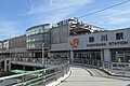
Transportation


Airways
Airports
Railways
Conventional lines
- Komaki Line:- Ajiyoshi – Kasugai – Ushiyama – Manai –
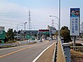
Expressway
Highways
 Tōmei Expressway
 Chūō Expressway
 Nagoya Dai-Ni Kanjo Expressway(Meinikan)
Japan National Route
-
 Nagoya Airport
 -
 Kachigawa Station
 -
 Kasugai Station
 -
 Meinikan and Jōhoku Line
 -
 Kasugai Interchange
 -


.jpg)
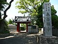
Local attractions


_7.JPG)
- Castle
- Jōjō Castle ruins
- Ōdome Castle
- Yoshida Castle
- Buddhist temple
- Enpuku-ji temple
- Kōzō-ji temple
- Mitsuzō-in temple
- Rinsyō-in temple
- Shintoku-ji temple
- Taigaku-ji temple
-
 Enpukuji temple
 -
 Mitsuzōin temple
 -
 Rinsyōin temple
 -
 Shintokuji temple
 -
 Taigakuji temple

_18.JPG)

_03.JPG)

- Shinto shrines
- Itahato Jinja
- Hakusan Jinja
- Matsubara Jinja
- Sakashita Jinja
- Utsutsu Jinja
-
 Itahato Jinja
 -
 Hakusan Jinja
 -
 Matsubara Jinja
 -
 Sakashita Jinja
 -
 Utsutsu Jinja

.jpg)


- Archaeological sites
- Library
- Kasugai city library
- Park
- Greenpia Kasugai
- Ochiai Park
Notable residents
- Ichiro Suzuki, professional baseball player
- Eiji Okuda, actor and director
- Takehiro Donoue, professional baseball player
- Naomichi Donoue, professional baseball player
- Sho Ito, professional soccer player
- Asahiyutaka Katsuteru, sumo wrestler
- Kousei Amano, actor
- Jurina Matsui, actress
- Gaku Hasegawa, politician
- Company Matsuo, pornographic movie actor/director
References
- ^ Kasugai City official statistics (in Japanese)
- ^ Kasugai climate data
- ^ Kasugai population statistics
- ^ "Sister Cities". City of Kelowna. Retrieved September 26, 2007.
- ^ 東春ハッキョ所在地. Toshun Korean Primary School. Retrieved October 14, 2015.
愛知県春日井市弥生町2047
External links
![]() Media related to Kasugai, Aichi at Wikimedia Commons
Media related to Kasugai, Aichi at Wikimedia Commons
- Official website (in Japanese) (with some portions in English)
| Nagoya |
| |||
|---|---|---|---|---|
| Core cities | ||||
| Special city | ||||
| Cities | ||||
| Districts | ||||
| Former Districts | ||||
| International | |
|---|---|
| National | |
| Geographic | |