
Kitami: Difference between revisions
Correction of the grammar, reformulation of phrases and addition of new references. |
→Towns and Autonomous Regions: convert pdf ex link 3X to Single ref invoke |
||
| (39 intermediate revisions by 30 users not shown) | |||
| Line 1: | Line 1: | ||
{{ |
{{Other uses}} |
||
{{Distinguish|Kitakami, Iwate{{!}}Kitakami}} |
|||
{{distinguish|Kitakyushu|Kitanagoya|Kitahiroshima, Hokkaido|Kitahiroshima, Hiroshima}} |
|||
{{Use mdy dates|date=October 2020}} |
{{Use mdy dates|date=October 2020}} |
||
{{Infobox settlement |
{{Infobox settlement |
||
| Line 9: | Line 9: | ||
| settlement_type = [[Cities of Japan|City]] |
| settlement_type = [[Cities of Japan|City]] |
||
| other_name = |
| other_name = |
||
| image_skyline = Kitami Montage 2.jpg |
|||
<!-- images, nickname, motto --> |
|||
| image_skyline = Kitami montage.JPG |
|||
| imagesize = |
| imagesize = |
||
| image_caption = Clockwise from top: |
| image_caption = Clockwise from top: Kitami Mint Memorial Museum, ADVICS TOKORO CURLING HALL, Street in Onneyu area, Kitami BBQ Festival in February, NORTHERN ARC RESORT, Pierson Memorial Museum |
||
| image_flag = Flag of Kitami, Hokkaido.svg |
| image_flag = Flag of Kitami, Hokkaido.svg |
||
| image_seal = |
| image_seal = Emblem of Kitami, Hokkaido.svg |
||
| seal_type = Emblem |
| seal_type = Emblem |
||
<!-- maps and coordinates --> |
|||
| image_map = Kitami in Hokkaido Prefecture Ja.svg |
| image_map = Kitami in Hokkaido Prefecture Ja.svg |
||
| map_alt = |
| map_alt = |
||
| Line 23: | Line 21: | ||
| pushpin_relief = |
| pushpin_relief = |
||
| pushpin_map_caption = Location in Japan |
| pushpin_map_caption = Location in Japan |
||
| coordinates = {{ |
| coordinates = {{Coord|43|48|11|N|143|53|41|E|region:JP-01_type:city(112,000)|display=inline,title}} |
||
| coordinates_footnotes = |
| coordinates_footnotes = |
||
<!-- location --> |
|||
| subdivision_type = Country |
| subdivision_type = Country |
||
| subdivision_name = Japan |
| subdivision_name = Japan |
||
| Line 34: | Line 31: | ||
| subdivision_type3 = [[Districts of Japan|District]] |
| subdivision_type3 = [[Districts of Japan|District]] |
||
| subdivision_name3 = |
| subdivision_name3 = |
||
<!-- established --> |
|||
| established_title = <!-- Settled --> |
| established_title = <!-- Settled --> |
||
| established_date = |
| established_date = |
||
| Line 41: | Line 37: | ||
| founder = |
| founder = |
||
| named_for = |
| named_for = |
||
| seat_type = |
|||
<!-- seat, smaller parts --> |
|||
| seat_type = <!-- defaults to: Seat --> |
|||
| seat = |
| seat = |
||
| government_footnotes = |
|||
<!-- government type, leaders --> |
|||
| government_footnotes = <!-- for references: use <ref> tags --> |
|||
| leader_party = |
| leader_party = |
||
| leader_title = Mayor |
| leader_title = Mayor |
||
| leader_name = |
| leader_name = [[:ja:辻直孝|Naotaka Tsuji]] (from September 2015) |
||
| leader_title1 = Vice Mayor |
| leader_title1 = Vice Mayor |
||
| leader_name1 = |
| leader_name1 = |
||
| total_type = |
|||
<!-- display settings --> |
|||
| total_type = <!-- to set a non-standard label for total area and population rows --> |
|||
| unit_pref = Metric |
| unit_pref = Metric |
||
| area_footnotes = |
|||
<!-- area --> |
|||
| area_total_km2 = 1427.41 |
|||
| area_magnitude = <!-- use only to set a special wikilink --> |
|||
| area_footnotes = <!-- for references: use <ref> tags --> |
|||
| area_total_km2 = 1427.56 |
|||
| area_land_km2 = |
| area_land_km2 = |
||
| area_water_km2 = |
| area_water_km2 = |
||
| area_water_percent = |
| area_water_percent = |
||
| area_note = |
| area_note = |
||
| elevation_footnotes = |
|||
<!-- elevation --> |
|||
| elevation_footnotes = <!-- for references: use <ref> tags --> |
|||
| elevation_m = |
| elevation_m = |
||
| population_footnotes = |
|||
<!-- population --> |
|||
| population_total = 112185 |
|||
| population_footnotes = <!-- for references: use <ref> tags --> |
|||
| population_as_of = July 31, 2023 |
|||
| population_total = 119,135 |
|||
| population_as_of = April 30, 2017 |
|||
| population_density_km2 = auto |
| population_density_km2 = auto |
||
| population_est = |
| population_est = |
||
| pop_est_as_of = |
| pop_est_as_of = |
||
<!-- time zone(s) --> |
|||
| timezone1 = [[Japan Standard Time|JST]] |
| timezone1 = [[Japan Standard Time|JST]] |
||
| utc_offset1 = +09:00 |
| utc_offset1 = +09:00 |
||
<!-- postal codes, area code --> |
|||
| postal_code_type = |
| postal_code_type = |
||
| postal_code = |
| postal_code = |
||
| area_code_type = |
| area_code_type = |
||
| area_code = |
| area_code = |
||
<!-- blank fields (section 1) --> |
|||
| blank_name_sec1 = City hall address |
| blank_name_sec1 = City hall address |
||
| blank_info_sec1 = 1 Higashi Ni-chōme, Kita Go-jō, Kitami-shi, Hokkaido<br />090-8501 |
| blank_info_sec1 = 1 Higashi Ni-chōme, Kita Go-jō, Kitami-shi, Hokkaido<br />090-8501 |
||
| blank_name_sec2 = [[Köppen climate classification|Climate]] |
|||
<!-- website, footnotes --> |
|||
| blank_info_sec2 = [[Humid continental climate|Dfb]] |
|||
| module = {{Infobox place symbols |
|||
|embedded = yes |
|||
|tree = [[Taxus cuspidata|Japanese yew]] |
|||
|flower = [[Chrysanthemum]] |
|||
|bird = |
|||
|flowering_tree = |
|||
|butterfly = |
|||
|fish = |
|||
|other_symbols = |
|||
}} |
|||
| website = {{URL|www.city.kitami.lg.jp/}} |
| website = {{URL|www.city.kitami.lg.jp/}} |
||
| footnotes = |
|||
| module = {{Infobox place symbols| embedded=yes |
|||
| tree = [[Japanese Yew]] |
|||
| flower = [[Chrysanthemum]] |
|||
| bird = |
|||
| flowering_tree = |
|||
| butterfly = |
|||
| fish = |
|||
| other_symbols = |
|||
}} |
|||
}} |
}} |
||
[[File:ワッカネイチャーセンター.jpg|thumb|Wakka Nature Center]] |
[[File:ワッカネイチャーセンター.jpg|thumb|Wakka Nature Center]] |
||
| Line 100: | Line 87: | ||
{{Nihongo|'''Kitami'''|北見市|Kitami-shi}} is a [[Cities of Japan|city]] in [[Okhotsk Subprefecture]], [[Hokkaido]], Japan. It is the most populous city and the commercial center in the subprefecture, although the subprefecture capital is [[Abashiri, Hokkaido|Abashiri]]. |
{{Nihongo|'''Kitami'''|北見市|Kitami-shi}} is a [[Cities of Japan|city]] in [[Okhotsk Subprefecture]], [[Hokkaido]], Japan. It is the most populous city and the commercial center in the subprefecture, although the subprefecture capital is [[Abashiri, Hokkaido|Abashiri]]. |
||
Kitami is physically in the middle of |
Kitami is physically in the middle of Okhotsk Subprefecture. The [[Kitami Mountains]] are nearby and are the main reason behind the city's name. The city is the result of the merger of Kitami, [[Tanno, Hokkaido|Tanno]], [[Tokoro, Hokkaido|Tokoro]] and [[Rubeshibe, Hokkaido|Rubeshibe]] towns in 2006 administrative reform. Kitami developed mainly in commerce and industry/service industries, Tanno in agriculture, Tokoro in fishery and agriculture, and Rubeshibe in forestry and tourism on hot springs. |
||
Due to the characteristics of the region, Kitami has the highest onion and white flower bean production in Japan. Scallop fishing also flourishes, which makes it the "birthplace of scallop farming" in the country. In addition, the region is home to historical and tourist places like the [[Pearson Museum]], [[Wakka Wild Flower Garden]], and [[Tokoro Ruins]], which are listed as "[[Hokkaidō Heritage|Hokkaido Heritage]]" sites<ref>{{Cite web|date=2015-06-29|title= |
Due to the characteristics of the region, Kitami has the highest onion and white flower bean production in Japan. Scallop fishing also flourishes, which makes it the "birthplace of scallop farming" in the country. In addition, the region is home to historical and tourist places like the [[Pearson Museum]], [[Wakka Wild Flower Garden]], and [[Tokoro Ruins]], which are listed as "[[Hokkaidō Heritage|Hokkaido Heritage]]" sites.<ref>{{Cite web |date=2015-06-29 |title=Kitami City information 2014 |url=http://www.city.kitami.lg.jp/docs/2014102800039/files/2014ALL.pdf |access-date=2021-12-18 |website= |archive-url=https://web.archive.org/web/20150629152613/http://www.city.kitami.lg.jp/docs/2014102800039/files/2014ALL.pdf |archive-date=29 June 2015 |url-status=dead}}</ref><ref>{{Cite web |title=Hokkaido Heritage sites |url=http://www.hokkaidoisan.org/jouhoushi/isane_06.pdf}}</ref> |
||
As of |
As of July 31, 2023, the city had a population of 112,185,<ref>{{cite web |url=http://www.city.kitami.lg.jp |title=Official website of Kitami City |publisher=Kitami City |location=Japan |language=ja |access-date=May 15, 2017}}</ref> citizens in 61,793 households. The population density is {{convert|78.6|pd/sqkm}} . The total area is {{cvt|1427.41|km2}}. |
||
== Etymology == |
== Etymology == |
||
The name came as a suggestion of the Japanese explorer and cartographer [[Matsuura Takeshirō]] during the [[Meiji (era)|Meiji Era]] when imperial bureaucrats were registering the place for initiating the region's development through the [[Hokkaidō Development Commission]]. Before the imperial intervention, there was no [[Ainu languages|Ainu]] name for the |
The name came as a suggestion of the Japanese explorer and cartographer [[Matsuura Takeshirō]] during the [[Meiji (era)|Meiji Era]], when imperial bureaucrats were registering the place for initiating the region's development through the [[Hokkaidō Development Commission]]. Before the imperial intervention, there was no [[Ainu languages|Ainu]] name for the region.<ref>{{Cite web |title=Kitami City Directory of 2021 |url=https://www.city.kitami.lg.jp/common/img/content/content_20210326_152506.pdf}}</ref> |
||
The meaning of the name consists of the kanji's combinations of characters 北 (North) 見 (See) and 市 (City), which means "''City of the North View''". The reason behind this meaning is due to the region's mountains |
The meaning of the name consists of the kanji's combinations of characters 北 (North) 見 (See) and 市 (City), which means "''City of the North View''". The reason behind this meaning is due to the region's mountains, which allow the view of the [[Sea of Okhotsk|sea]] and the Russian island of [[Sakhalin]]. |
||
Originally, the name refers to a vast area between the [[Kitami Mountains| |
Originally, the name refers to a vast area between the [[Kitami Mountains|mountains]] and the [[Sea of Okhotsk]]. Since the merger of Kitami City with the surrounding [[Tokoro, Hokkaido|Tokoro]], [[Rubeshibe, Hokkaido|Rubeshibe]] and [[Tanno, Hokkaido|Tanno]] towns in 2006, it is often referred to as the area around the Kitami Basin, the so-called Kitami Inland Area, excluding the former Tokoro Town area in the coastal area.<ref>{{Cite web |title=Kitami City Directory 2021 |url=https://www.city.kitami.lg.jp/common/img/content/content_20210326_152506.pdf}}</ref> |
||
==Chronology== |
==Chronology== |
||
=== The Edo period === |
=== The Edo period === |
||
The [[Edo period]] is the period between 1603 and 1867 in the [[History of Japan|history]] of [[Japan]], when Japan was under the rule of the [[Tokugawa shogunate]] and the country's 300 regional ''[[daimyo]]''. During this period, there is no registration of continuous human settlement in this place. The nearest populations were composed of [[Ainu people|Ainu]] Tribes. Nowadays, one of their old settlements has become the [[Tokoro Ruins]]. The history began to appear in the final years of the Edo period, as a result of the [[Meiji Restoration]] and the [[Boshin War]] |
The [[Edo period]] is the period between 1603 and 1867 in the [[History of Japan|history]] of [[Japan]], when Japan was under the rule of the [[Tokugawa shogunate]] and the country's 300 regional ''[[daimyo]]''. During this period, there is no registration of continuous human settlement in this place. The nearest populations were composed of [[Ainu people|Ainu]] Tribes. Nowadays, one of their old settlements has become the [[Tokoro Ruins]]. The history began to appear in the final years of the Edo period, as a result of the [[Meiji Restoration]] and the [[Boshin War]].<ref>{{Cite web |title=Japan's Boshin War: End of the Shogun |url=https://www.thoughtco.com/the-boshin-war-in-japan-195568 |access-date=2021-12-18 |website=ThoughtCo |language=en}}</ref> |
||
* 1856: Japanese explorer [[Matsuura Takeshirō]] passed over the region for the first time on the [[Tokoro River]]. |
* 1856: Japanese explorer [[Matsuura Takeshirō]] passed over the region for the first time on the [[Tokoro River]]. |
||
=== Meiji |
=== Meiji Era === |
||
The [[Meiji (era)|Meiji era]] is an [[Japanese era name|era]] of [[History of Japan|Japanese history]] that extended from October 23, 1868 to July 30, 1912. In this period, the [[Boshin War]] was over and the short-lived [[Republic of Ezo|Ezo Republic]] was conquered by the Japanese Imperial Army. Due to the risk of having new revolts in the border of the empire and the constant expansion of the [[Russian conquest of Siberia|Russian Empire]] at the north, the imperial bureau started the mass colonisation of the region and the "Japanization" of the natives through forced assimilation and segregation<ref>{{Cite news|date=2008-06-06|title=Recognition at last for Japan's Ainu|language=en-GB|url=http://news.bbc.co.uk/1/hi/world/asia-pacific/7437244.stm|access-date=2021-12-22}}</ref> |
The [[Meiji (era)|Meiji era]] is an [[Japanese era name|era]] of [[History of Japan|Japanese history]] that extended from October 23, 1868, to July 30, 1912. In this period, the [[Boshin War]] was over and the short-lived [[Republic of Ezo|Ezo Republic]] was conquered by the Japanese Imperial Army. Due to the risk of having new revolts in the border of the empire and the constant expansion of the [[Russian conquest of Siberia|Russian Empire]] at the north, the imperial bureau started the mass colonisation of the region and the "Japanization" of the natives through forced assimilation and segregation.<ref>{{Cite news |date=2008-06-06 |title=Recognition at last for Japan's Ainu |language=en-GB |url=http://news.bbc.co.uk/1/hi/world/asia-pacific/7437244.stm |access-date=2021-12-22}}</ref> |
||
* 1869 (Meiji 2): The Meiji government renames Ezo as "Hokkaido" |
* 1869 (Meiji 2): The Meiji government renames Ezo as "Hokkaido" and creates the [[Hokkaidō Development Commission]].<ref>{{Cite web |title=Kitami's tourism Yearbook (Japanese) |url=http://kitamikanko.jp/kankotext/index.html}}</ref> |
||
* 1872 (Meiji 5): The village of {{Nihongo||ノツケウシ村|Notsukeushi-mura}} is founded, starting the process of settle in the region. |
* 1872 (Meiji 5): The village of {{Nihongo||ノツケウシ村|Notsukeushi-mura}} is founded, starting the process of settle in the region. |
||
* 1882 (Meiji 15): [[Hokkaidō Development Commission]] is abolished, and the first three prefectures are established in Hokkaido. This area belonged to Nemuro prefecture, one of those firstly created. |
* 1882 (Meiji 15): [[Hokkaidō Development Commission]] is abolished, and the first three prefectures are established in Hokkaido. This area belonged to Nemuro prefecture, one of those firstly created. |
||
* 1897 (Meiji 30): 112 immigrants arrives and settle, which led to the substantial growth of the region<ref>{{Cite web|title=Kitami Tourist Yearbook, page 10 (Japanese)|url=http://kitamikanko.jp/kankotext/pdf/010.pdf |
* 1897 (Meiji 30): 112 immigrants arrives and settle, which led to the substantial growth of the region.<ref>{{Cite web |title=Kitami Tourist Yearbook, page 10 (Japanese) |url=http://kitamikanko.jp/kankotext/pdf/010.pdf}}</ref> |
||
* 1899 (Meiji 32): Is produced the first mint in the region<ref>{{Cite web|title=Kitami City Yearbook 2021|url=https://www.city.kitami.lg.jp/common/img/content/content_20210326_152506.pdf |
* 1899 (Meiji 32): Is produced the first mint in the region.<ref>{{Cite web |title=Kitami City Yearbook 2021 |url=https://www.city.kitami.lg.jp/common/img/content/content_20210326_152506.pdf}}</ref> |
||
* 1904 (Meiji 37): Rice cultivation begins. |
* 1904 (Meiji 37): Rice cultivation begins. |
||
* 1910 (Meiji 43): Train service arrives (then called the Ikeda Railway Line), connecting the village to [[Sapporo]], capital of Hokkaido.<ref name="train_arrives" /> |
* 1910 (Meiji 43): Train service arrives (then called the Ikeda Railway Line), connecting the village to [[Sapporo]], capital of Hokkaido.<ref name="train_arrives" /> |
||
=== Taishō |
=== Taishō Era === |
||
[[Taishō]] is a period dating from 30 July 1912 to 25 December 1926, coinciding with the reign of the [[Emperor Taishō]]. During this Era, the emperor wasn't capable of using his power due to [[Meningitis|cerebral meningitis]] contracted in his childhood. Because of his personal limitations, the imperial government was led informally by an [[oligarchy]] of notables called [[Genrō]] (元老). Thanks to this power vacuum, Japan developed a political system that allowed a liberal government, with the creation of political parties and a major role of the [[National Diet]] |
[[Taishō]] is a period dating from 30 July 1912 to 25 December 1926, coinciding with the reign of the [[Emperor Taishō]]. During this Era, the emperor wasn't capable of using his power due to [[Meningitis|cerebral meningitis]] contracted in his childhood. Because of his personal limitations, the imperial government was led informally by an [[oligarchy]] of notables called [[Genrō]] (元老). Thanks to this power vacuum, Japan developed a political system that allowed a liberal government, with the creation of political parties and a major role of the [[National Diet]].<ref>{{Cite web |title=WW1 & 1920s |url=https://www.grips.ac.jp/teacher/oono/hp/lecture_J/lec07.htm |access-date=2021-12-24 |website=www.grips.ac.jp}}</ref> |
||
* 1914 (Taisho 3): [[Pearson Museum]] is opened in the old house of the Pearson, an american couple of missionaries. |
|||
* 1914 (Taisho 3): [[Pearson Museum]] is opened in the old house of the Pearson, an American couple of missionaries. |
|||
* 1915 (Taisho 4): Tokoro Village is created. |
* 1915 (Taisho 4): Tokoro Village is created. |
||
* 1921 (Taisho 10): Rubeshibe Town is created. |
* 1921 (Taisho 10): Rubeshibe Town is created. |
||
=== Showa |
=== Showa Era === |
||
This [[Shōwa (1926–1989)|chapter]] of [[Japan |
This [[Shōwa (1926–1989)|chapter]] of [[Japan]]ese history corresponds to the reign of Emperor Shōwa ([[Hirohito]]) from December 25, 1926, until his death on January 7, 1989. This time represents the most intense changes in Kitami, Hokkaido, and Japan. In the beginning, the city started to specialise in the production of Mint, meanwhile, the Empire of Japan was under a militaristic [[Japanese militarism|rule]] with expansionist actions that led to the participation of the country in the Second World War.<ref>{{Cite web |title=Banking Crisis |url=https://www.grips.ac.jp/teacher/oono/hp/lecture_J/lec08.htm |access-date=2021-12-24 |website=www.grips.ac.jp}}</ref><ref>{{Cite web |title=1930s & War |url=https://www.grips.ac.jp/teacher/oono/hp/lecture_J/lec09.htm |access-date=2021-12-24 |website=www.grips.ac.jp}}</ref> |
||
After the end of the conflict, Japan started to concentrate its economic efforts on mass industrialisation<ref>{{Cite web|title=Recovery|url=https://www.grips.ac.jp/teacher/oono/hp/lecture_J/lec10.htm|access-date=2021-12-24|website=www.grips.ac.jp}}</ref> |
After the end of the conflict, Japan started to concentrate its economic efforts on mass industrialisation,<ref>{{Cite web |title=Recovery |url=https://www.grips.ac.jp/teacher/oono/hp/lecture_J/lec10.htm |access-date=2021-12-24 |website=www.grips.ac.jp}}</ref> which, in consequence, led Japan to the second most important economy in the world. Kitami had an industrial development during this progress and the city reached its highest population in the middle of the 80s.<ref>{{Cite web |title=Slowdown |url=https://www.grips.ac.jp/teacher/oono/hp/lecture_J/lec12.htm |access-date=2021-12-24 |website=www.grips.ac.jp}}</ref> |
||
* 1928 (Showa 3): Mr. and Mrs. Pearson leave Kitami and come back to the United States. |
* 1928 (Showa 3): Mr. and Mrs. Pearson leave Kitami and come back to the United States. |
||
* 1934 (Showa 9): The [[Japanese Red Cross Society|Japanese Red Cross]] hospital is completed. |
* 1934 (Showa 9): The [[Japanese Red Cross Society|Japanese Red Cross]] hospital is completed. |
||
* 1934 (Showa 9): Kitami's Mint Memorial Hall is opened. |
* 1934 (Showa 9): Kitami's Mint Memorial Hall is opened. |
||
* 1939 (Showa 14): Kitami's mint production gets 70% of the world market and reaches its peak. |
* 1939 (Showa 14): Kitami's mint production gets 70% of the world market and reaches its peak. |
||
* 1942 (Showa 17): Kitami becomes a city. |
* 1942 (Showa 17): Kitami becomes a city. |
||
* 1947 (Showa 22): 50th anniversary of the creation of Kitami City. Enactment of the Kitami City coat of arms. |
* 1947 (Showa 22): 50th anniversary of the creation of Kitami City. Enactment of the Kitami City coat of arms. |
||
* 1954 (Showa 29): "Kitami Commerce and Industry Festival" |
* 1954 (Showa 29): "Kitami Commerce and Industry Festival" is held for the first time |
||
* 1960 (Showa 35): Establishment of Kitami College of Technology. |
* 1960 (Showa 35): Establishment of the [[Kitami Institute of Technology|Kitami College of Technology]]. |
||
* 1971 (Showa 46): "Kitami Winter Festival" held for the first time |
* 1971 (Showa 46): "Kitami Winter Festival" held for the first time. |
||
* 1979 (Showa 54): The population of Kitami City exceeds 100,000. |
* 1979 (Showa 54): The population of Kitami City exceeds 100,000. |
||
* 1983 (Showa 58): The 100th anniversary of the creation of Tokoro. |
* 1983 (Showa 58): The 100th anniversary of the creation of Tokoro. |
||
| Line 157: | Line 144: | ||
=== Heisei Era === |
=== Heisei Era === |
||
Is the [[Japanese era name|period]] corresponding to the reign of Emperor [[Akihito]] from 8 January 1989 until his [[2019 Japanese imperial transition|abdication]] on 30 April 2019. Heisei's era was marked by turbulent politics and a prolonged economic slowdown<ref>{{Cite web|title=Bubble burst|url=https://www.grips.ac.jp/teacher/oono/hp/lecture_J/lec13.htm|access-date=2021-12-24|website=www.grips.ac.jp}}</ref> |
Is the [[Japanese era name|period]] corresponding to the reign of Emperor [[Akihito]] from 8 January 1989 until his [[2019 Japanese imperial transition|abdication]] on 30 April 2019. Heisei's era was marked by turbulent politics and a prolonged economic slowdown.<ref>{{Cite web |title=Bubble burst |url=https://www.grips.ac.jp/teacher/oono/hp/lecture_J/lec13.htm |access-date=2021-12-24 |website=www.grips.ac.jp}}</ref> Since the economic downturn, Kitami never recovered its economic dimensions since the burst of the [[Lost Decades|Japanese financial crisis]] and its population started to slowly decrease until nowadays. In this era, the actual city administrative divisions were created. |
||
* 1991 (Heisei 3): "Solar Challenge in Hokkaido" (solar car race) held for the first time (ended in 2003). |
* 1991 (Heisei 3): "Solar Challenge in Hokkaido" (solar car race) held for the first time (ended in 2003). |
||
| Line 165: | Line 152: | ||
* 2000 (Heisei 12): "Kitami Severe Cold Yakiniku Festival" was held for the first time. |
* 2000 (Heisei 12): "Kitami Severe Cold Yakiniku Festival" was held for the first time. |
||
* 2001 (Heisei 13): The [[Pearson Museum]] and [[Wakka Wild Flower Garden]] are selected as "Hokkaido Heritage". |
* 2001 (Heisei 13): The [[Pearson Museum]] and [[Wakka Wild Flower Garden]] are selected as "Hokkaido Heritage". |
||
* 2004 (Heisei 16): A record blizzard hits (snow cover {{Convert|171|cm|in}} |
* 2004 (Heisei 16): A record blizzard hits (snow cover {{Convert|171|cm|in}}. Ancient archaeological sites along the Okhotsk coast including the Tokoro archaeological site are selected as "Hokkaido heritage". |
||
* 2006 (Heisei 18): Kitami, Tokoro, Rubeshibe and Tanno surges as City of Kitami. |
* 2006 (Heisei 18): Kitami, Tokoro, Rubeshibe and Tanno surges as City of Kitami. |
||
* 2008 (Heisei 20): The first community broadcast "FM Okhotsk" |
* 2008 (Heisei 20): The first community broadcast "FM Okhotsk" opens. |
||
* 2009 (Heisei 21): "Kitami Half Marathon" held for the first time. |
* 2009 (Heisei 21): "Kitami Half Marathon" held for the first time. |
||
* 2014 (Heisei 26): Kitami's daily maximum temperature recorded the highest value (37.2 |
* 2014 (Heisei 26): Kitami's daily maximum temperature recorded the highest value until 2019 (37.2 °C). |
||
=== Reiwa |
=== Reiwa Era === |
||
[[Reiwa]] is the current [[Japanese era name|era of Japan's official calendar]]. It began on 1 May 2019, the day on which Emperor [[Akihito]]'s elder son, [[Naruhito]], [[Enthronement of the Japanese emperor|ascended the throne]] as the 126th [[Emperor of Japan]]. |
[[Reiwa]] is the current [[Japanese era name|era of Japan's official calendar]]. It began on 1 May 2019, the day on which Emperor [[Akihito]]'s elder son, [[Naruhito]], [[Enthronement of the Japanese emperor|ascended the throne]] as the 126th [[Emperor of Japan]]. |
||
* 2019 (first year of Reiwa): On May 26, the highest temperature in the history of observation was observed in Kitami City at 38.1 C. |
* 2019 (first year of Reiwa): On May 26, the highest temperature in the history of observation was observed in Kitami City at 38.1 °C, beating the 2014 record. |
||
== Towns and Autonomous Regions == |
== Towns and Autonomous Regions == |
||
Kitami is the result of the administrative unification of small towns with the main city, which was made in 2006. Thanks to this merging, Kitami is the biggest city in the [[Okhotsk Subprefecture]]. These small towns still exist as ''Autonomous Region Districts'' (自治区). There are 4 autonomous regions/towns in total. |
Kitami is the result of the administrative unification of small towns with the main city, which was made in 2006. Thanks to this merging, Kitami is the biggest city in the [[Okhotsk Subprefecture]]. These small towns still exist as ''Autonomous Region Districts'' (自治区). There are 4 autonomous regions/towns in total. |
||
=== City of Kitami === |
|||
Translated as ''North View'' (北見), it is the main urban area of the region. The city flourished during the prewar era through the production of mint, which at the time accounted for 70% of world production. Nowadays Kitami is the commercial, industrial, and service center of the [[Okhotsk Subprefecture|Okhotsk]] area. The government makes efforts to develop the city through an industry-academia-government collaboration involving universities and other higher education institutions that are also based in the area. |
Translated as ''North View'' (北見), it is the main urban area of the region. The city flourished during the prewar era through the production of mint, which at the time accounted for 70% of world production. Nowadays Kitami is the commercial, industrial, and service center of the [[Okhotsk Subprefecture|Okhotsk]] area. The government makes efforts to develop the city through an industry-academia-government collaboration involving universities and other higher education institutions that are also based in the area.<ref name="city20210326">{{cite web |date=March 26, 2021 |title=Kitami City Directory 2021 (English) |website=Kitami City |url=https://www.city.kitami.lg.jp/common/img/content/content_20210326_152506.pdf }}</ref> |
||
==== Town of Tanno ==== |
|||
Translated as ''Edge Field'' (端野) which is based in the native Ainu name ''nufu-un-keshi'' (''edge of the field''), the district is mainly a farm field with smooth hills and a rural landscape in the [[Tokoro, Hokkaido|Tokoro]] river basin. The district has an educational zone with elementary and junior high schools, social education facilities, and parks in the main centre of the district. The rural landscape is also shaped by farms with urban convenience. In the last population survey (2005) the town had an estimated [[population]] of 5,425 and a [[Population density|density]] of 33 persons per km². The total area was 163.50 km². |
|||
=== Town of Tanno === |
|||
{{See also|Tanno, Hokkaido}} |
{{See also|Tanno, Hokkaido}} |
||
Translated as ''Edge Field'' (端野) which is based in the native Ainu name ''nufu-un-keshi'' (''edge of the field''), the district is mainly a farm field with smooth hills and a rural landscape in the [[Tokoro, Hokkaido|Tokoro]] river basin. The district has an educational zone with elementary and junior high schools, social education facilities, and parks in the main centre of the district. The rural landscape is also shaped by farms with urban convenience. In the last population survey (2005) the town had an estimated [[population]] of 5,425 and a [[Population density|density]] of 33 persons per km<sup>2</sup>. The total area was 163.50 km<sup>2</sup>. |
|||
==== Town of Tokoro ==== |
|||
Agriculture and fisheries thrive in this district with abundant nature, including Wakka Wild Flower Park, where flowers stand out on the sandbar between the Sea of Okhotsk and [[Lake Saroma]]. It has a year-round curling hall, which is one of the largest of its kind in Japan, as well as historical sites such as the Tokoro Site and the birthplace of scallop cultivation. [https://www.city.kitami.lg.jp/common/img/content/content_20210326_152506.pdf] As of 2004, the town had an estimated [[population]] of 4,885 and a [[Population density|density]] of 17.55 persons per km². The total area was 278.29 km². |
|||
=== Town of Tokoro === |
|||
{{See also|Tokoro, Hokkaido}} |
{{See also|Tokoro, Hokkaido}} |
||
Agriculture and fisheries thrive in this district with abundant nature, including Wakka Wild Flower Park, where flowers stand out on the sandbar between the Sea of Okhotsk and [[Lake Saroma]]. It has a year-round curling hall, which is one of the largest of its kind in Japan, as well as historical sites such as the Tokoro Site and the birthplace of scallop cultivation.<ref name="city20210326" /> As of 2004, the town had an estimated [[population]] of 4,885 and a [[Population density|density]] of 17.55 persons per km<sup>2</sup>. The total area was 278.29 km<sup>2</sup>. |
|||
==== Town of Rubeshibe ==== |
|||
Translated as ''Legacy of the Detained Pistils'' (留辺蘂), the district is surrounded by thick forests at the foot of the [[Taisetsu]] mountains and along the Muka River. Its key industries are [[Phaseolus vulgaris|White Flower]] (shirohana-mame) beans production, for which it boasts the nation’s largest yield, and the forest products industry, which uses locally produced wood. As a tourist spot, Yama no Aquarium (Kita no Daichi no Aquarium) in the Onneyu Onsen resort is attracting nationwide attention with its unique display tanks. [https://www.city.kitami.lg.jp/common/img/content/content_20210326_152506.pdf]. Before the unification with Kitami, the town had an estimated [[population]] of 8,704 and a [[Population density|density]] of 15.41 persons per km². The total area was 564.69 km². |
|||
=== Town of Rubeshibe === |
|||
{{See also|Rubeshibe, Hokkaido}} |
{{See also|Rubeshibe, Hokkaido}} |
||
[[File:Kitami's city map with the autonomous regions.jpg|center|thumb|538x538px|Map with the actual administrative division of the city. District of Rubeshibe (Pink), City of Kitami (Green), District of Tanno (Red) and District of Tokoro (Yellow).]] |
|||
Translated as ''Legacy of the Detained Pistils'' (留辺蘂), the district is surrounded by thick forests at the foot of the [[Taisetsu]] mountains and along the Muka River. Its key industries are [[Phaseolus vulgaris|White Flower]] (shirohana-mame) beans production, for which it boasts the nation's largest yield, and the forest products industry, which uses locally produced wood. As a tourist spot, Yama no Aquarium (Kita no Daichi no Aquarium) in the Onneyu Onsen resort is attracting nationwide attention with its unique display tanks.<ref name="city20210326" /> Before the unification with Kitami, the town had an estimated [[population]] of 8,704 and a [[Population density|density]] of 15.41 persons per km<sup>2</sup>. The total area was 564.69 km<sup>2</sup>. |
|||
==Economy== |
|||
==Economy== |
|||
=== History and actual situation === |
=== History and actual situation === |
||
Kitami's first economy was the natural production of ''Mentha'' ([[Mentha|Mint]]). During at one time (pre-war) the region exported [[Mentha|mint]] (known as ''hakka'' locally) in a scale that represented the supply of 70% of the world's mint consumption at its peak.<ref name="hakka" /><ref name="peppermint_era" /> Nowadays |
Kitami's first economy was the natural production of ''Mentha'' ([[Mentha|Mint]]). During at one time (pre-war) the region exported [[Mentha|mint]] (known as ''hakka'' locally) in a scale that represented the supply of 70% of the world's mint consumption at its peak.<ref name="hakka" /><ref name="peppermint_era" /> Nowadays it is the most important city of the [[Okhotsk Subprefecture|Okhotsk region]]. Due to its size, Kitami is the main industrial and commercial pole of the region. The number of employees by industry is divided by 7.6% for the primary industry, 18.8% for the secondary industry, and 73.6% for the tertiary industry (2010). These economic proportions are comparable to major cities in Hokkaido but, in terms of primary industry, the percentage is higher when compared with other cities alike.<ref>{{Cite web |title=Kitami City Statistical Data 2020 |url=https://www.city.kitami.lg.jp/common/img/content/content_20211209_154058.pdf}}</ref> |
||
=== Agriculture === |
=== Agriculture === |
||
The extensive farmlands of the city are surrounded by grand nature stretches over 110 km east to west from the foot of the [[Taisetsu]] mountains to the [[Sea of Okhotsk]] coast. Abundant sunlight and fertile soil support the production of diverse produce, including rice, wheat/barley, potatoes, beet, beans and other upland crops, onions and other vegetables, as well as dairy products, beef, pork and other livestock products.Efforts are being made to produce diverse farm products by making the most of the climate and characteristics of each district. Clean agriculture harmonious with the natural environment is promoted by minimising the use of chemical fertilisers and synthetic pesticides to deliver safe, reliable and high-quality farm products to consumers.<ref>{{Cite web |title=Kitami City Directory 2021 |url=https://www.city.kitami.lg.jp/common/img/content/content_20210326_152540.pdf}}</ref> |
|||
; Onions |
|||
The total production of onions in FY 2019 was approximately 221,000 tons, accounting for roughly 25% of the total production of Hokkaido as well as being the largest yield in Japan. The total area of onion fields in the city is approximately 3,500 hectares. Farmers are busy transplanting seedlings in spring, and rows of large, plump onions fill vast fields in autumn. |
The total production of onions in FY 2019 was approximately 221,000 tons, accounting for roughly 25% of the total production of Hokkaido as well as being the largest yield in Japan. The total area of onion fields in the city is approximately 3,500 hectares. Farmers are busy transplanting seedlings in spring, and rows of large, plump onions fill vast fields in autumn. |
||
* '''White |
* '''White Pea Beans''' |
||
White |
[[Navy bean|White Pea Beans]] are known as the “queen of beans”. These pure white, large-grained beans are used as an ingredient for the white bean paste in high-class Japanese confectionery. Kitami, which has a cool, inland climate, is ideal for cultivating white pea beans and is a major production area in Hokkaido. The large and tasty white pea beans produced in Kitami are distributed as high-grade beans throughout Japan. |
||
=== Fishery === |
=== Fishery === |
||
In Kitami, which faces the resource-rich Sea of Okhotsk and Lake Saroma, open-sea scallop and fixed-net salmon/trout fisheries are among the |
In Kitami, which faces the resource-rich [[Sea of Okhotsk]] and [[Lake Saroma]], open-sea scallop and fixed-net salmon/trout fisheries are among the city's key industries. Hairy crabs, sea urchin and flatfish are also caught, and [[sustainable fishery]] is promoted. Scallop and oyster farming and Hokkai shrimp fishing are popular on the lake. The Tokoro Fishing Port is being developed to provide safer and more reliable seafood. With an eye on the conservation of the fishing ground environment, fishing operators are actively engaged in tree planting activities to grow forests.<ref>{{Cite web |title=Kitami City Directory 2021 |url=https://www.city.kitami.lg.jp/common/img/content/content_20210326_152540.pdf}}</ref> |
||
* '''Scallops''' |
* '''Scallops''' |
||
The [[lake Saroma]] is the birthplace of [[scallop]] farming. After many hardships, fishermen established propagation and culture technology to build the foundation of the Tokoro area as one of the |
The [[lake Saroma]] is the birthplace of [[scallop]] farming. After many hardships, fishermen established propagation and culture technology to build the foundation of the Tokoro area as one of the world's leading scallop producing areas. The scallops grown in Lake Saroma and the Sea of Okhotsk are plump and sweet, and have an exceptional texture. They are distributed all over the world as a luxury food item. |
||
* '''Oysters and Hokkai shrimp''' |
* '''Oysters and Hokkai shrimp''' |
||
From mid-October to the end of March, oyster fishing is popular on Lake Saroma. The oysters, which are small yet have a rich flavor, are highly valued especially for eating raw. |
From mid-October to the end of March, oyster fishing is popular on Lake Saroma. The oysters, which are small yet have a rich flavor, are highly valued especially for eating raw. Hokkai shrimp, which is shipped only in July and August, is mainly boiled in salt. With a saltiness that pairs perfectly with sake, moderate elasticity, crispy texture, and sweetness that spreads in the mouth, it is known as a summer specialty of the Okhotsk area. |
||
=== Industry === |
=== Industry === |
||
Efforts to |
Efforts to revitalise the local economy include the "cultivation" of new sales channels and the development of new products with higher added value to overcome the problem of logistics costs. Product development is promoted via inter-industry collaboration and by attracting enterprises to the Kitami Industrial Complex and Kitami HighTech Park, both of which make the most of local resources. Kitami Institute of Technology's Cooperative Research & Community Collaboration Center serves as a contact point for joint research with the private sector. The Okhotsk Collaborative Research Center and the Kitami Office of the Hokkaido Branch of the Organization for Small & Medium Enterprises and Regional Innovation have been established as “one-stop service bases” to support R&D and commercialization in the local community. Measures to promote local industries, such as the enhancement of technological capabilities and the development of new products, are taken while strengthening industry-academia-government collaboration. There is important private enterprises installed in the city like [[Kyocera|Kyocera Corporation]] and [[Hitachi|Hitachi, Ltd.]]<ref>{{Cite web |title=Manufacturing companies in Kitami |url=https://www.dnb.com/business-directory/company-information.manufacturing.jp.hokkaido.kitami.html}}</ref> |
||
=== Commerce === |
=== Commerce === |
||
As the central city of the Okhotsk area, Kitami has expanded its retail trading zone in the last years. The commercial district in the downtown area, where retail, service and restaurant establishments are concentrated, has long been a place for interaction among citizens. Various events are held to make the commercial district more attractive. A new shopping zone formed in the suburbs has further livened up the commercial sector of Kitami. Lively and diverse commercial activities are promoted by making the most of local creativity while facilitating the participation of local residents in the development of a community. In financial matters, the annual sales of both wholesale and retail businesses in Kitami City are declining, and the number of business establishments and employees is also declining. This decline occur mainly due the [[Lost Decades|Japanese economic crisis]], [[Aging of Japan|faster ageing population]] and [[Rural flight|urban exodus]]. In the tourism industry, there are about 1.5 million tourists a year, mainly in Lake Saroma and Onneyu Onsen. However, the total number of overnight guests has been around 450,000 a year, making it a so-called “passing-type” tourist destination.<gallery mode="packed" widths="300" heights="210" class="middle"> |
As the central city of the Okhotsk area, Kitami has expanded its retail trading zone in the last years. The commercial district in the downtown area, where retail, service and restaurant establishments are concentrated, has long been a place for interaction among citizens. Various events are held to make the commercial district more attractive. A new shopping zone formed in the suburbs has further livened up the commercial sector of Kitami. Lively and diverse commercial activities are promoted by making the most of local creativity while facilitating the participation of local residents in the development of a community. In financial matters, the annual sales of both wholesale and retail businesses in Kitami City are declining, and the number of business establishments and employees is also declining. This decline occur mainly due the [[Lost Decades|Japanese economic crisis]], [[Aging of Japan|faster ageing population]] and [[Rural flight|urban exodus]]. In the tourism industry, there are about 1.5 million tourists a year, mainly in Lake Saroma and Onneyu Onsen. However, the total number of overnight guests has been around 450,000 a year, making it a so-called “passing-type” tourist destination. |
||
<gallery mode="packed" widths="300" heights="210" class="middle"> |
|||
File:Kitami street.jpg|Downtown of the City |
File:Kitami street.jpg|Downtown of the City |
||
File:AEON-Kitami1.JPG|An Aeon's retail store in Kitami |
File:AEON-Kitami1.JPG|An Aeon's retail store in Kitami |
||
| Line 236: | Line 223: | ||
==Education== |
==Education== |
||
Kitami is home to the [[Kitami Institute of Technology]], an engineering university that originally opened in 1960,<ref name="kit_about"/> and the [[Japanese Red Cross Hokkaido College of Nursing]], established in 1999 by the [[Japanese Red Cross]] through consolidation of several other institutions.<ref name="hcn_history"/> |
Kitami is home to the [[Kitami Institute of Technology]], an engineering university that originally opened in 1960,<ref name="kit_about"/> and the [[Japanese Red Cross Hokkaido College of Nursing]], established in 1999 by the [[Japanese Red Cross]] through consolidation of several other institutions.<ref name="hcn_history"/> The ''Kitami Central Library'' is the main library of the city. In December 2015, the library was relocated to a new building on the south side, making it easily accessible from the downtown area. The library has a collection of approximately 330,000 books and supports the learning of residents with a network of nine facilities in the city, which have 799,000 books in total. It provides an audiovisual area where DVDs and music can be enjoyed and a literature museum area that exhibits valuable materials of the poet [[Mokichi Saitō|Mokichi Saito]]. PCs and Wi-Fi can be used freely by residents and non-residents alike. New services such as e-books are also available.<ref>{{Cite web |title=Kitami Yearbook of 2021 |url=https://www.city.kitami.lg.jp/common/img/content/content_20210326_152603.pdf}}</ref> |
||
===Universities=== |
===Universities=== |
||
====National==== |
====National==== |
||
* [[Kitami Institute of Technology]] |
* [[Kitami Institute of Technology]] |
||
| Line 247: | Line 233: | ||
===High schools=== |
===High schools=== |
||
====Public==== |
====Public==== |
||
* Hokkaido Kitami Hokuto High School |
* Hokkaido Kitami Hokuto High School |
||
| Line 261: | Line 246: | ||
==Festivals== |
==Festivals== |
||
*The Kitami Winter Festival, held annually during the 2nd week of February.<ref name="fuyu"/> |
* The Kitami Winter Festival, held annually during the 2nd week of February.<ref name="fuyu"/> |
||
*The Kitami Bonchi Festival (Summer Festival) in early July.<ref name="bonchi"/> |
* The Kitami Bonchi Festival (Summer Festival) in early July.<ref name="bonchi"/> |
||
*The Kitami Chrysanthemum festival in mid October−early November.<ref name="kikumatsuri"/> |
* The Kitami Chrysanthemum festival in mid October−early November.<ref name="kikumatsuri"/> |
||
== |
==Mascots== |
||
{{multiple image |
|||
| align = right |
|||
| direction = horizontal |
|||
| total_width = 500 |
|||
| footer = Mint-kun, Pepper-chan, Nonta-kun, Nonta-chan, Matsubo, Tokoro-kun and Ecolon, the city's mascots |
|||
| footer_align = center |
|||
| image1 = Mint-kun and Pepper-chan.png |
|||
| image2 = Nonta-kun and Nonko-chan.png |
|||
| image3 = Matsubo.png |
|||
| image4 = Tokoro-kun.png |
|||
| image5 = Ecolon.png |
|||
}} |
|||
Kitami's mascots are {{Nihongo|'''Mint-kun'''|ミントくん}}, {{Nihongo|'''Pepper-chan'''|ペッパーちゃん}}, {{Nihongo|'''Nonta-kun'''|のんたくん}}, {{Nihongo|'''Nonta-chan'''|のんこちゃん}}, {{Nihongo|'''Matsubo'''|まつぼう}}, {{Nihongo|'''Tokoro-kun'''|ところくん}} and {{Nihongo|'''Ecolon'''|エコロン}}.<ref>{{cite web |url=https://www.okhotsk.pref.hokkaido.lg.jp/fs/2/1/8/2/8/4/4/_/ohocharamember2.pdf |title=オホ☆キャラ隊 |website=Hokkaido}}</ref><ref>{{cite web |url=https://www.city.kitami.lg.jp/administration/life/detail.php?content=7476 |title=マスコットキャラクター エコロン |website=Kitami}}</ref><ref>{{cite web |url=https://kawaii.hokkaido.jp/character/tokorokun/ |title=ところくんのプロフィール(北見市) |website=Kawaii Hokkaido}}</ref> |
|||
* Mint-kun and Pepper-chan are married squirrels. They ate so much food that they are rounded. Mint-kun likes to hack things (he once boosted 70% of the world market) while Pepper-chan likes fresh air. They represent technology and cuisine. |
|||
==== Newspapers ==== |
|||
* Nonta-kun and Nonta-chan are farmers from Tanno. They wear red hat with wheat ears. Their faces looked like onions and their shoes look like rice. They represent agriculture. |
|||
* Matsubo is a pinecone from Rubeshibe. He loves shopping. His charms points are his scales and his eyes. He represents tourism. |
|||
* Tokoro-kun is a sporty scallop from Tokoro. He represents sports and fisheries. |
|||
* Ecolon is a seed (which resembled the recycling symbol) with wings. Her hair (seedling) can spin like [[Doraemon]]'s take-copter. When she flies by, everything turns green. She represents the environment. |
|||
== Mass media == |
|||
* [[Hokkaido Shimbun]] - Kitami Branch |
|||
=== Newspapers === |
|||
* [[Yomiuri Shimbun]] - Hokkaido's Kitami Branch |
|||
* [[ |
* ''[[Hokkaido Shimbun]]''—Kitami Branch |
||
* [[ |
* ''[[Yomiuri Shimbun]]''—Hokkaido's Kitami Branch |
||
* |
* ''[[The Asahi Shimbun|Asahi Shimbun]]''—Hokkaido's Kitami Branch |
||
* ''[[Mainichi Shimbun]] Hokkaido's Kitami Communication Department |
|||
* ''Hokkaido Construction Newspaper''—Kitami Branch |
|||
==== Tabloids ==== |
|||
=== Tabloids === |
|||
* Densho Hato Kitami Headquarters, Rubeshibe Office |
* Densho Hato Kitami Headquarters, Rubeshibe Office |
||
* Doshin information magazine |
* Doshin information magazine ''Mint'' |
||
* Gra Style |
* ''Gra Style'' |
||
==== Broadcasting station ==== |
|||
===== TV ===== |
|||
=== Broadcasting stations === |
|||
==== TV ==== |
|||
* [[NHK]] Kitami Broadcasting Station |
* [[NHK]] Kitami Broadcasting Station |
||
* [[Hokkaido Broadcasting]] (HBC) Kitami Broadcasting Station |
* [[Hokkaido Broadcasting]] (HBC) Kitami Broadcasting Station |
||
* [[Sapporo Television Broadcasting]] (STV) Kitami Broadcasting Station |
* [[Sapporo Television Broadcasting]] (STV) Kitami Broadcasting Station |
||
==== Radio ==== |
|||
* FM Okhotsk |
* FM Okhotsk |
||
==Sports== |
==Sports== |
||
===Curling=== |
===Curling=== |
||
The city has strong associations with the sport of [[curling]], inherited from the former town of [[Tokoro, Hokkaido|Tokoro]] absorbed into the city in 2006. Interest in the sport grew following a friendship visit in 1980 by a curling team from [[Alberta]] in Canada.<ref name="kitakami_curling">{{cite web|url= |
The city has strong associations with the sport of [[curling]], inherited from the former town of [[Tokoro, Hokkaido|Tokoro]], which was absorbed into the city in 2006. Interest in the sport grew following a friendship visit in 1980 by a curling team from [[Alberta]] in Canada.<ref name="kitakami_curling">{{cite web |url=http://www.city.kitami.lg.jp/docs/7251/ |title=Curling |publisher=City of Kitakami |location=Japan |language=ja |access-date=February 1, 2014 |archive-url=https://web.archive.org/web/20150629175859/http://www.city.kitami.lg.jp/docs/7251/ |archive-date=June 29, 2015 |url-status=dead}}</ref> An outdoor curling rink was built in Tokoro the following year, and it hosted the 1st NHK Cup Curling Championship.<ref name="kitakami_curling"/> In January 1988, the town built a dedicated 5-lane [[curling]] hall, the first in Japan.<ref name="asahi20130129">{{cite web |url=http://www.asahi.com/area/hokkaido/articles/MTW20130129010200001.html |script-title=ja:常呂町カーリングホール 今季限り |trans-title=Tokoro Curling Hall to close at the end of this season |date=January 29, 2013 |work=Asahi Shimbun Digital |publisher=The Asahi Shimbun Company |location=Japan |language=ja |archive-url=https://web.archive.org/web/20130215061217/http://www.asahi.com/area/hokkaido/articles/MTW20130129010200001.html |archive-date=February 15, 2013 |url-status=dead |access-date=February 1, 2014}}</ref> This eventually closed in early 2013, replaced by a new, larger, all-year-round structure.<ref name="asahi20130129"/> |
||
Curling was introduced in schools in Tokoro as part of the [[physical education]] curriculum, and the two produced a number of Olympic curlers.<ref name="kitakami_curling"/> Five members of the Japanese curling team at the [[1998 Winter Olympics]] in Nagano were from Tokoro, three members of the Japanese curling team at the [[2006 Winter Olympics]] in Torino were from Tokoro, and three members of the Japanese curling team at the [[2010 Winter Olympics]] in Vancouver were from Tokoro.<ref name="kitakami_curling"/> |
Curling was introduced in schools in Tokoro as part of the [[physical education]] curriculum, and the two produced a number of Olympic curlers.<ref name="kitakami_curling"/> Five members of the Japanese curling team at the [[1998 Winter Olympics]] in Nagano were from Tokoro, three members of the Japanese curling team at the [[2006 Winter Olympics]] in Torino were from Tokoro, and three members of the Japanese curling team at the [[2010 Winter Olympics]] in Vancouver were from Tokoro.<ref name="kitakami_curling"/> |
||
== |
== Geography == |
||
Kitami City is located in a mild valley close to the [[Kitami Mountains]]. This Mountains, especially the Mount Mikuni, is where the headwaters of the [[Tokoro River]] are located. The river belongs to in-Mukagawa basin, which leads to the [[Sea of Okhotsk]]. This course has more than 110 km of extension. Tokoro Autonomous Region district has its limits based in the course of the basin. Besides of the Sea of Okhotsk and Lake Saroma, there is the Abashiri Quasi-National Park, where is located the Wakka Natural Flower Garden.<ref>{{Cite web |title=The charm of Kitami-city |url=https://www.city.kitami.lg.jp/common/img/content/content_20210326_152506.pdf}}</ref> The park is listed as a Hokkaido heritage site. |
|||
Kitami has a [[humid continental climate]] with cold winters and relatively warm summers. The coldest month is January, with an average low of {{convert|−14.7|C|F|1}}, and the warmest month is August, with an average high of {{convert|25|C}}. Kitami's inland location creates a larger temperature range than some coastal cities. Due to the mountains nearby, the [[Foehn wind]] effect occurs in summer when prevailing winds are from the southeast, so that Kitami often has the hottest temperatures in Hokkaido during this season and averages about 5 °C (9 °F) hotter than [[Kushiro, Hokkaido|Kushiro]]. Traces of snow fall every day during the winter and cover is heavy, usually peaking at {{convert|0.82|m|in|2}}, though Kitami still receives less overall precipitation than any other town in Japan as it is shielded from the heaviest moisture from both the [[Sea of Japan]] and Pacific Ocean. |
|||
=== Features === |
|||
==== Terrain and mountains ==== |
|||
* Mt. Mukayama (1,759 m) |
|||
* Mt. Mikuni (1,541 m) |
|||
* Kitami Fuji (1,291 m) |
|||
* Nikoroyama (829 m) |
|||
==== Rivers ==== |
|||
* [[Tokoro River]] |
|||
* Kunneppu River |
|||
* Mukagawa |
|||
* Nikoro River |
|||
* Komachigawa |
|||
==== Lakes ==== |
|||
* [[Lake Saroma]] |
|||
* Lake Tomisato |
|||
=== Vegetation === |
|||
* Mainly Wakka primitive flower |
|||
=== Climate === |
|||
Kitami has a [[humid continental climate]] with cold winters and relatively warm summers. The coldest month is January, with an average low of {{convert|−14.7|C|F|1}}, and the warmest month is August, with an average high of {{convert|25|C}}. Kitami's inland location creates a larger temperature range than some coastal cities. Due to the mountains nearby, the [[Foehn wind]] effect occurs in summer when prevailing winds are from the southeast, so that Kitami often has the hottest temperatures in Hokkaido during this season and averages about 5 °C (9 °F) hotter than [[Kushiro, Hokkaido|Kushiro]]. Traces of snow fall every day during the winter and cover is heavy, usually peaking at {{convert|0.82|m|in|2}}, though Kitami still receives less overall precipitation than any other town in Japan as it is shielded from the heaviest moisture from both the [[Sea of Japan]] and Pacific Ocean. University of Tokyo's snow monitoring system is located in the city, which main coverage consist in the area of eastern Hokkaido. |
|||
{{Weather box|width=auto |
{{Weather box|width=auto |
||
|location = Kitami, Hokkaido ( |
|location = Kitami, Hokkaido (1991−2020 normals, extremes 1976−present) |
||
|metric first = Y |
|metric first = Y |
||
|single line = Y |
|single line = Y |
||
|Jan high C = |
|Jan high C = -2.6 |
||
|Feb high C = |
|Feb high C = -1.6 |
||
|Mar high C = |
|Mar high C = 3.3 |
||
|Apr high C = 11. |
|Apr high C = 11.1 |
||
|May high C = 17. |
|May high C = 17.8 |
||
|Jun high C = 21. |
|Jun high C = 21.3 |
||
|Jul high C = 24. |
|Jul high C = 24.6 |
||
|Aug high C = 25. |
|Aug high C = 25.4 |
||
|Sep high C = 21. |
|Sep high C = 21.7 |
||
|Oct high C = 15. |
|Oct high C = 15.5 |
||
|Nov high C = |
|Nov high C = 7.6 |
||
|Dec high C = |
|Dec high C = 0.0 |
||
|year high C= |
|year high C= 12.0 |
||
|Jan mean C =-8. |
|Jan mean C =-8.0 |
||
|Feb mean C =-7. |
|Feb mean C =-7.4 |
||
|Mar mean C =- |
|Mar mean C =-1.9 |
||
|Apr mean C = |
|Apr mean C = 5.1 |
||
|May mean C = |
|May mean C = 11.2 |
||
|Jun mean C = 15. |
|Jun mean C = 15.4 |
||
|Jul mean C = |
|Jul mean C = 19.1 |
||
|Aug mean C = 20.2 |
|Aug mean C = 20.2 |
||
|Sep mean C = |
|Sep mean C = 16.2 |
||
|Oct mean C = |
|Oct mean C = 9.5 |
||
|Nov mean C = 2. |
|Nov mean C = 2.4 |
||
|Dec mean C = -5. |
|Dec mean C = -5.1 |
||
|year mean C = 6. |
|year mean C = 6.4 |
||
|Jan low C = |
|Jan low C = -14.2 |
||
|Feb low C = |
|Feb low C = -14.0 |
||
|Mar low C = |
|Mar low C = -7.6 |
||
|Apr low C = |
|Apr low C = -0.6 |
||
|May low C = |
|May low C = 5.2 |
||
|Jun low C = |
|Jun low C = 10.3 |
||
|Jul low C = |
|Jul low C = 14.7 |
||
|Aug low C = |
|Aug low C = 15.9 |
||
|Sep low C = |
|Sep low C = 11.3 |
||
|Oct low C = |
|Oct low C = 3.9 |
||
|Nov low C = |
|Nov low C = -2.6 |
||
|Dec low C = |
|Dec low C = -10.8 |
||
|year low C= |
|year low C= 1.0 |
||
|Jan record high C = |
|Jan record high C = 8.0 |
||
|Feb record high C = |
|Feb record high C = 9.8 |
||
|Mar record high C = 24.2 |
|Mar record high C = 24.2 |
||
|Apr record high C = 32.2 |
|Apr record high C = 32.2 |
||
|May record high C = 38.1 |
|May record high C = 38.1 |
||
|Jun record high C = |
|Jun record high C = 37.2 |
||
|Jul record high C = |
|Jul record high C = 37.2 |
||
|Aug record high C = 37. |
|Aug record high C = 37.1 |
||
|Sep record high C = 32. |
|Sep record high C = 32.7 |
||
|Oct record high C = 27.7 |
|Oct record high C = 27.7 |
||
|Nov record high C = 22.0 |
|Nov record high C = 22.0 |
||
|Dec record high C = 14.5 |
|Dec record high C = 14.5 |
||
|year record high C= 38.1 |
|year record high C= 38.1 |
||
|Jan record low C = |
|Jan record low C = -30.1 |
||
|Feb record low C = |
|Feb record low C = -30.9 |
||
|Mar record low C = |
|Mar record low C = -24.3 |
||
|Apr record low C = |
|Apr record low C = -14.0 |
||
|May record low C = |
|May record low C = -4.8 |
||
|Jun record low C = |
|Jun record low C = -0.9 |
||
|Jul record low C = |
|Jul record low C = 3.4 |
||
|Aug record low C = |
|Aug record low C = 6.3 |
||
|Sep record low C = |
|Sep record low C = 0.3 |
||
|Oct record low C = |
|Oct record low C = -5.7 |
||
|Nov record low C = |
|Nov record low C = -16.3 |
||
|Dec record low C = |
|Dec record low C = -24.6 |
||
|year record low C= |
|year record low C= -30.9 |
||
|precipitation colour = green |
|precipitation colour = green |
||
|Jan precipitation mm = |
|Jan precipitation mm = 39.3 |
||
|Feb precipitation mm = |
|Feb precipitation mm = 29.0 |
||
|Mar precipitation mm = |
|Mar precipitation mm = 35.1 |
||
|Apr precipitation mm = |
|Apr precipitation mm = 45.0 |
||
|May precipitation mm = |
|May precipitation mm = 56.2 |
||
|Jun precipitation mm = |
|Jun precipitation mm = 66.2 |
||
|Jul precipitation mm = |
|Jul precipitation mm = 94.5 |
||
|Aug precipitation mm = |
|Aug precipitation mm = 128.9 |
||
|Sep precipitation mm = |
|Sep precipitation mm = 111.8 |
||
|Oct precipitation mm = |
|Oct precipitation mm = 77.2 |
||
|Nov precipitation mm = |
|Nov precipitation mm = 40.3 |
||
|Dec precipitation mm = |
|Dec precipitation mm = 51.3 |
||
|Jan snow cm = |
|Jan snow cm = 109 |
||
|Feb snow cm = |
|Feb snow cm = 85 |
||
|Mar snow cm = |
|Mar snow cm = 81 |
||
|Apr snow cm = |
|Apr snow cm = 26 |
||
|May snow cm = |
|May snow cm = 1 |
||
|Jun snow cm = |
|Jun snow cm = 0 |
||
|Jul snow cm = |
|Jul snow cm = 0 |
||
|Aug snow cm = |
|Aug snow cm = 0 |
||
|Sep snow cm = |
|Sep snow cm = 0 |
||
|Oct snow cm = |
|Oct snow cm = 0 |
||
|Nov snow cm = |
|Nov snow cm = 16 |
||
|Dec snow cm = |
|Dec snow cm = 92 |
||
|unit precipitation days = 1.0 mm |
|unit precipitation days = 1.0 mm |
||
|Jan precipitation days = |
|Jan precipitation days = 8.5 |
||
|Feb precipitation days = |
|Feb precipitation days = 7.4 |
||
|Mar precipitation days = |
|Mar precipitation days = 8.9 |
||
|Apr precipitation days = |
|Apr precipitation days = 8.9 |
||
|May precipitation days = |
|May precipitation days = 9.2 |
||
|Jun precipitation days = |
|Jun precipitation days = 9.0 |
||
|Jul precipitation days = 10. |
|Jul precipitation days = 10.0 |
||
|Aug precipitation days = 10. |
|Aug precipitation days = 10.3 |
||
|Sep precipitation days = 10. |
|Sep precipitation days = 10.4 |
||
|Oct precipitation days = |
|Oct precipitation days = 8.8 |
||
|Nov precipitation days = |
|Nov precipitation days = 7.9 |
||
|Dec precipitation days = |
|Dec precipitation days = 9.1 |
||
|unit snow days = |
|unit snow days = 3 cm |
||
|Jan snow days = |
|Jan snow days = 11.3 |
||
|Feb snow days = |
|Feb snow days = 10.3 |
||
|Mar snow days = |
|Mar snow days = 10.1 |
||
|Apr snow days = |
|Apr snow days = 3.2 |
||
|May snow days = |
|May snow days = 0.1 |
||
|Jun snow days = |
|Jun snow days = 0 |
||
|Jul snow days = |
|Jul snow days = 0 |
||
|Aug snow days = |
|Aug snow days = 0 |
||
|Sep snow days = |
|Sep snow days = 0 |
||
|Oct snow days = |
|Oct snow days = 0 |
||
|Nov snow days = |
|Nov snow days = 2.1 |
||
|Dec snow days = |
|Dec snow days = 9.9 |
||
|Jan sun = |
|Jan sun = 106.1 |
||
|Feb sun = |
|Feb sun = 119.5 |
||
|Mar sun = |
|Mar sun = 157.6 |
||
|Apr sun = |
|Apr sun = 165.5 |
||
|May sun = |
|May sun = 174.9 |
||
|Jun sun = |
|Jun sun = 157.2 |
||
|Jul sun = |
|Jul sun = 153.4 |
||
|Aug sun = |
|Aug sun = 148.5 |
||
|Sep sun = |
|Sep sun = 148.0 |
||
|Oct sun = |
|Oct sun = 153.8 |
||
|Nov sun = |
|Nov sun = 126.8 |
||
|Dec sun = |
|Dec sun = 112.9 |
||
|source 1 = [[Japan Meteorological Agency]]<ref>{{cite web |url=http://www.data.jma.go.jp/obd/stats/etrn/view/nml_amd_ym.php?prec_no=17&prec_ch=%96%D4%91%96%8Ex%92%A1&block_no=0074&block_ch=%96k%8C%A9&year=&month=&day=&elm=normal&view= |title=平年値(年・月ごとの値) |access-date=March 17, 2010 |publisher=Japan Meteorological Agency}}</ref> |
|||
|source 1 = [[Japan Meteorological Agency]]<ref>{{cite web |
|||
| |
|source 2 = [[Japan Meteorological Agency]]<ref>{{cite web |url=http://www.data.jma.go.jp/obd/stats/etrn/view/rank_a.php?prec_no=17&prec_ch=%96%D4%91%96%8Ex%92%A1&block_no=0074&block_ch=%96k%8C%A9&year=&month=&day=&elm=rank&view= |title=観測史上1~10位の値(年間を通じての値) |access-date=March 17, 2010 |publisher=Japan Meteorological Agency}}</ref> |
||
| title = 平年値(年・月ごとの値) | access-date = March 17, 2010 | publisher = Japan Meteorological Agency |
|||
}}</ref> |
|||
|source 2 = [[Japan Meteorological Agency]]<ref>{{cite web |
|||
| url = http://www.data.jma.go.jp/obd/stats/etrn/view/rank_a.php?prec_no=17&prec_ch=%96%D4%91%96%8Ex%92%A1&block_no=0074&block_ch=%96k%8C%A9&year=&month=&day=&elm=rank&view= |
|||
| title = 観測史上1~10位の値(年間を通じての値)| access-date = March 17, 2010 | publisher = Japan Meteorological Agency |
|||
}}</ref> |
|||
|date=August 2010 |
|date=August 2010 |
||
}} |
}} |
||
| Line 448: | Line 465: | ||
===Highway=== |
===Highway=== |
||
*[[File: |
*[[File:JP Expressway E61.svg|25px|link=|alt=]] [[Tokachi-Okhotsk Expressway]] |
||
*{{jct|country=JPN|Route|39}} |
*{{jct|country=JPN|Route|39}} |
||
| Line 471: | Line 488: | ||
==Notable people from Kitami== |
==Notable people from Kitami== |
||
* [[Shinya Abe]], Japanese [[curling|curler]] and curling coach |
|||
* [[Jake Lee (wrestler)|Jake Lee]], [[Zainichi Korean]] professional wrestler (Real Name: ''Lee Che-Gyong'', [[Hangul]]: 이 체경) |
|||
* [[Shinya Abe]], Japanese [[curling|curler]] and curling coach |
|||
* [[Miz (singer)|Miz]], Japanese pop/rock singer and actress (Real Name: Mizuki Watanabe, [[Nihongo]]: 渡邊瑞枝, ''Watanabe Mizuki'') |
|||
* [[Whiteberry (music group)|Whiteberry]], five-piece all-girl pop/rock band |
|||
* [[Kosuke Aita]], Japanese [[curling|curler]] |
* [[Kosuke Aita]], Japanese [[curling|curler]] |
||
* [[Satsuki Fujisawa]], Japanese [[curling|curler]] ([[Skip (curling)|Skipper]]) |
|||
* [[Yumie Funayama]], Japanese [[curling|curler]] (Real Name: Yumie Hayashi, [[Nihongo]]: 林 弓枝, ''Hayashi Yumie'') |
|||
* [[Takuya Furuya]], Japanese [[professional baseball]] [[pitcher]] for the [[Chiba Lotte Marines]] in Japan's [[Nippon Professional Baseball]] |
* [[Takuya Furuya]], Japanese [[professional baseball]] [[pitcher]] for the [[Chiba Lotte Marines]] in Japan's [[Nippon Professional Baseball]] |
||
* [[Chinami Yoshida]], Japanese [[curling|curler]] and older sister of [[Yurika Yoshida]] |
|||
* [[Yurika Yoshida]], Japanese [[curling|curler]] and younger sister of [[Chinami Yoshida]] |
|||
* [[Akira Takase]], Japanese [[association football|footballer]] ([[ReinMeer Aomori]]) and older brother of [[Megumi Takase]] |
|||
* [[Megumi Takase]], former Japanese football player and younger sister of [[Akira Takase]] |
|||
* [[Sayaka Yoshimura]], Japanese [[curling|curler]] |
|||
* [[Makoto Tsuruga]], Japanese [[curling|curler]] |
|||
* [[Osamu Uno]], [[Politics of Japan|Japanese politician]] of the [[Liberal Democratic Party (Japan)|Liberal Democratic Party]] and a member of the [[House of Representatives of Japan|House of Representatives]] in the [[Diet of Japan|Diet]] (national legislature). |
|||
* [[Tsuyoshi Ryutaki]], Japanese male [[curling|curler]] |
|||
* [[Kiyofumi Ohno]], [[Japanese pop]] singer-songwriter |
|||
* [[Yasumasa Tanida]], Japanese [[curling|curler]] |
|||
* [[Yoshiyuki Ohmiya]], Japanese [[curling|curler]] and curling coach |
|||
* [[Ayumi Ogasawara]], Japanese [[curling|curler]] and curling coach |
|||
* [[Mari Motohashi]], Japanese [[curling|curler]] |
|||
* [[Akemi Niwa]], Japanese [[curling|curler]], a three-time {{PACC||Pacific-Asian champion}} (1993, 1997, 1998) and a three-time [[Japan Curling Championships|Japan women's champion]] (1997, 1998, 1999) |
|||
* [[Ami Kikuchi]], Japanese [[gravure idol]], ''[[tarento]]'', radio personality and [[J-pop]] idol, former member of [[J-pop]] girlgroup [[Idoling!!!]] |
|||
* [[Chiharu Kitaoka]], Japanese [[Voice acting in Japan|voice actress]] |
|||
* [[Yuta Matsumura]], Japanese [[curling|curler]] |
|||
* [[Taro Kondo]], Japanese [[speed skating|speed skater]] |
|||
* [[Tatsuki Nara]], Japanese [[Association football|footballer]] who plays for [[J1 League]] club [[Kashima Antlers]].<ref name="soccerway">{{cite web | url = https://int.soccerway.com/players/tatsuki-nara/191591/ | title = Tatsuki Nara at Soccerway | access-date = March 10, 2012 | publisher=Soccerway}}</ref> |
|||
* [[Kazuhiko Ikawa]], Japanese [[curling|curler]] |
* [[Kazuhiko Ikawa]], Japanese [[curling|curler]] |
||
* [[Takehiko Itō]], Japanese [[manga artist]] (''[[NG Knight Ramune & 40]]'', ''[[Outlaw Star]]'', among others) |
|||
* [[Mao Ishigaki]], Japanese [[curling|curler]] |
* [[Mao Ishigaki]], Japanese [[curling|curler]] |
||
* [[ |
* [[Takehiko Itō]], Japanese [[manga artist]] (''[[NG Knight Ramune & 40]]'', ''[[Outlaw Star]]'', among others) |
||
* [[Ami Kikuchi]], Japanese [[gravure idol]], ''[[tarento]]'', radio personality and [[J-pop]] idol, former member of [[J-pop]] girl group [[Idoling!!!]] |
|||
* [[Satsuki Fujisawa]], Japanese [[curling|curler]] ([[Skip (curling)|Skipper]]) |
|||
* [[Chiharu Kitaoka]], Japanese [[Voice acting in Japan|voice actress]] |
|||
* [[Taro Kondo]], Japanese [[speed skating|speed skater]] |
|||
* [[Jake Lee (wrestler)|Jake Lee]], [[Zainichi Korean]] professional wrestler (Real Name: ''Lee Che-Gyong'', [[Hangul]]: 이 체경) |
|||
* [[Yuta Matsumura (curler)|Yuta Matsumura]], Japanese [[curling|curler]] |
|||
* [[Miz (singer)|Miz]], Japanese pop/rock singer and actress (Real Name: Mizuki Watanabe, [[Nihongo]]: 渡邊瑞枝, ''Watanabe Mizuki'') |
|||
* [[Mari Motohashi]], Japanese [[curling|curler]] |
|||
* [[Tatsuki Nara]], Japanese [[Association football|footballer]] who plays for [[J1 League]] club [[Avispa Fukuoka]].<ref name="J.League">{{cite web |url=https://www.jleague.co/players/546/Tatsuki-NARA/ |title=Tatsuki Nara |access-date=April 19, 2023 |publisher=J.League}}</ref> |
|||
* [[Akemi Niwa]], Japanese [[curling|curler]], a three-time {{PACC||Pacific-Asian champion}} (1993, 1997, 1998) and a three-time [[Japan Curling Championships|Japan women's champion]] (1997, 1998, 1999) |
|||
* [[Ayumi Ogasawara]], Japanese [[curling|curler]] and curling coach |
|||
* [[Yoshiyuki Ohmiya]], Japanese [[curling|curler]] and curling coach |
|||
* [[Kiyofumi Ohno]], [[Japanese pop]] singer-songwriter |
|||
* [[Tsuyoshi Ryutaki]], Japanese male [[curling|curler]] |
|||
* [[Hiroshi Sato (curler)|Hiroshi Sato]], Japanese [[curling|curler]] and curling coach |
* [[Hiroshi Sato (curler)|Hiroshi Sato]], Japanese [[curling|curler]] and curling coach |
||
* [[Yumi Suzuki]], Japanese [[curling|curler]] |
|||
* [[Yōsuke Shinoda]], [[Politics of Japan|Japanese politician]] of the [[Liberal Democratic Party (Japan)|Liberal Democratic Party]] and a member of the [[House of Representatives of Japan|House of Representatives]] in the [[Diet of Japan|Diet]] (national legislature). |
* [[Yōsuke Shinoda]], [[Politics of Japan|Japanese politician]] of the [[Liberal Democratic Party (Japan)|Liberal Democratic Party]] and a member of the [[House of Representatives of Japan|House of Representatives]] in the [[Diet of Japan|Diet]] (national legislature). |
||
* [[Yumi Suzuki]], Japanese [[curling|curler]] |
|||
* [[Megumi Takase]], former Japanese football player and younger sister of [[Akira Takase]] |
|||
* [[Akira Takase]], Japanese [[association football|footballer]] ([[ReinMeer Aomori]]) and older brother of [[Megumi Takase]] |
|||
* [[Yasumasa Tanida]], Japanese [[curling|curler]] |
|||
* [[Makoto Tsuruga]], Japanese [[curling|curler]] |
|||
* [[Osamu Uno]], [[Politics of Japan|Japanese politician]] of the [[Liberal Democratic Party (Japan)|Liberal Democratic Party]] and a member of the [[House of Representatives of Japan|House of Representatives]] in the [[Diet of Japan|Diet]] (national legislature) |
|||
* [[Whiteberry (music group)|Whiteberry]], five-piece all-girl pop/rock band |
|||
* [[Chinami Yoshida]], Japanese [[curling|curler]] and older sister of [[Yurika Yoshida]] |
|||
* [[Yurika Yoshida]], Japanese [[curling|curler]] and younger sister of [[Chinami Yoshida]] |
|||
* [[Sayaka Yoshimura]], Japanese [[curling|curler]] |
|||
==In pop culture== |
==In pop culture== |
||
The 2019 [[manga]] series ''[[Hokkaido Gals Are Super Adorable!]]'' is set in Kitami and its author, Kai Ikada, is a native of the city.<ref>{{cite web|url=https://denshobato.com/BD/N/page.php?id=118445|script-title=ja:北見出身の漫画家・伊科田 海さん(25)|publisher=Denshobato|language=ja|date=December 24, 2019|access-date=October 8, 2020}}</ref> |
The 2019 [[manga]] series ''[[Hokkaido Gals Are Super Adorable!]]'' is set in Kitami and its author, Kai Ikada, is a native of the city.<ref>{{cite web |url=https://denshobato.com/BD/N/page.php?id=118445 |script-title=ja:北見出身の漫画家・伊科田 海さん(25) |publisher=Denshobato |language=ja |date=December 24, 2019 |access-date=October 8, 2020}}</ref> |
||
== |
== Citations == |
||
{{Reflist|30em|refs= |
{{Reflist|30em|refs= |
||
<ref name="hakka">{{Cite web |url=http://www.kitamikanko.jp/english/21_hakka.html |title=Kitami Mint Commemoration Hall Mint Distillation Hall |publisher=Kitami Tourism |access-date=May 29, 2011 |archive-date=July 22, 2011 |archive-url=https://web.archive.org/web/20110722112033/http://www.kitamikanko.jp/english/21_hakka.html |url-status=dead}}</ref> |
|||
<ref name="hakka"> |
|||
{{Cite web |
|||
|url=http://www.kitamikanko.jp/english/21_hakka.html |
|||
|title=Kitami Mint Commemoration Hall Mint Distillation Hall |
|||
|work=kitamikanko.jp |
|||
|publisher=Kitami Tourism |
|||
|access-date=May 29, 2011 |
|||
}}</ref> |
|||
<ref name="peppermint_era"> |
<ref name="peppermint_era"> |
||
{{Cite web |url=http://www.city.kitami.lg.jp/docs/3296/index.html.r |title=Peppermint Era Inns |publisher=City of Kitami |access-date=May 29, 2011 |url-status=dead |archive-url=https://web.archive.org/web/20110721154204/http://www.city.kitami.lg.jp/docs/3296/index.html.r |archive-date=July 21, 2011}}</ref> |
|||
{{Cite web |
|||
|url=http://www.city.kitami.lg.jp/docs/3296/index.html.r |
|||
|title=Peppermint Era Inns |
|||
|work=city.kitami.lg.jp |
|||
|publisher=City of Kitami |
|||
|access-date=May 29, 2011 |url-status=dead |
|||
|archive-url=https://web.archive.org/web/20110721154204/http://www.city.kitami.lg.jp/docs/3296/index.html.r |
|||
|archive-date=July 21, 2011 }}</ref> |
|||
<ref name="train_arrives"> |
<ref name="train_arrives"> |
||
{{Cite web |url=http://www.city.kitami.lg.jp/docs/3297/index.html.r |title=The Inconvenient Journey between Sapporo and Nokkeushi−the Opening of the Ikeda Railway Line |publisher=City of Kitami |access-date=May 29, 2011 |url-status=dead |archive-url=https://web.archive.org/web/20110721154232/http://www.city.kitami.lg.jp/docs/3297/index.html.r |archive-date=July 21, 2011}}</ref> |
|||
{{Cite web |
|||
|url=http://www.city.kitami.lg.jp/docs/3297/index.html.r |
|||
|title=The Inconvenient Journey between Sapporo and Nokkeushi−the Opening of the Ikeda Railway Line |
|||
|work=city.kitami.lg.jp |
|||
|publisher=City of Kitami |
|||
|access-date=May 29, 2011 |url-status=dead |
|||
|archive-url=https://web.archive.org/web/20110721154232/http://www.city.kitami.lg.jp/docs/3297/index.html.r |
|||
|archive-date=July 21, 2011 }}</ref> |
|||
<ref name="kit_about"> |
<ref name="kit_about"> |
||
{{Cite web |url=http://www.kitami-it.ac.jp/old/eng/04/index1.html |title=Facts about the Kitami Institute of Technology |website=kitami-it.ac.jp |publisher=National University Corporation |access-date=May 29, 2011 |url-status=dead |archive-url=https://web.archive.org/web/20110224160748/http://www.kitami-it.ac.jp/old/eng/04/index1.html |archive-date=February 24, 2011}}</ref> |
|||
{{Cite web |
|||
|url=http://www.kitami-it.ac.jp/old/eng/04/index1.html |
|||
|title=Facts about the Kitami Institute of Technology |
|||
|work=kitami-it.ac.jp |
|||
|publisher=National University Corporation |
|||
|access-date=May 29, 2011 |url-status=dead |
|||
|archive-url=https://web.archive.org/web/20110224160748/http://www.kitami-it.ac.jp/old/eng/04/index1.html |
|||
|archive-date=February 24, 2011 }}</ref> |
|||
<ref name="hcn_history"> |
<ref name="hcn_history"> |
||
{{Cite web |url=http://www.rchokkaido-cn.ac.jp/information/gaiyou.html |title=History |publisher=Japanese Red Cross Hokkaido College of Nursing |access-date=May 29, 2011 |url-status=dead |archive-url=https://web.archive.org/web/20111023044611/http://www.rchokkaido-cn.ac.jp/information/gaiyou.html |archive-date=October 23, 2011}}</ref> |
|||
{{Cite web |
|||
|url = http://www.rchokkaido-cn.ac.jp/information/gaiyou.html |
|||
|title = History |
|||
|work = rchokkaido-cn.ac.jp |
|||
|publisher = Japanese Red Cross Hokkaido College of Nursing |
|||
|access-date = May 29, 2011 |
|||
|url-status = dead |
|||
|archive-url = https://web.archive.org/web/20111023044611/http://www.rchokkaido-cn.ac.jp/information/gaiyou.html |
|||
|archive-date = October 23, 2011 |
|||
}}</ref> |
|||
<ref name="fuyu">{{Cite web |url=http://www.kitamikanko.jp/english/35_02_fuyu.html |title=Kitami Winter Festival |publisher=Kitami Tourism |access-date=May 29, 2011 |archive-date=October 21, 2016 |archive-url=https://web.archive.org/web/20161021123315/http://www.kitamikanko.jp/english/35_02_fuyu.html |url-status=dead}}</ref> |
|||
<ref name="fuyu"> |
|||
{{Cite web |
|||
|url=http://www.kitamikanko.jp/english/35_02_fuyu.html |
|||
|title=Kitami Winter Festival |
|||
|work=kitamikanko.jp |
|||
|publisher=Kitami Tourism |
|||
|access-date=May 29, 2011 |
|||
}}</ref> |
|||
<ref name="bonchi">{{Cite web |url=http://www.kitamikanko.jp/english/40_07_k_bonchi.html |title=Kitami Bonchi Festival |publisher=Kitami Tourism |access-date=May 29, 2011 |archive-date=October 25, 2016 |archive-url=https://web.archive.org/web/20161025111604/http://www.kitamikanko.jp/english/40_07_k_bonchi.html |url-status=dead}}</ref> |
|||
<ref name="bonchi"> |
|||
{{Cite web |
|||
|url=http://www.kitamikanko.jp/english/40_07_k_bonchi.html |
|||
|title=Kitami Bonchi Festival |
|||
|work=kitamikanko.jp |
|||
|publisher=Kitami Tourism |
|||
|access-date=May 29, 2011 |
|||
}}</ref> |
|||
<ref name="kikumatsuri">{{Cite web |url=http://www.kitamikanko.jp/english/48_10_k_kiku.html |title=Kitami Chrysanthemum Festival |publisher=Kitami Tourism |access-date=May 29, 2011 |archive-date=October 25, 2016 |archive-url=https://web.archive.org/web/20161025111934/http://www.kitamikanko.jp/english/48_10_k_kiku.html |url-status=dead}}</ref> |
|||
<ref name="kikumatsuri"> |
|||
{{Cite web |
|||
|url=http://www.kitamikanko.jp/english/48_10_k_kiku.html |
|||
|title=Kitami Chrysanthemum Festival |
|||
|work=kitamikanko.jp |
|||
|publisher=Kitami Tourism |
|||
|access-date=May 29, 2011 |
|||
}}</ref> |
|||
<ref name="bus"> |
<ref name="bus"> |
||
{{Cite web |url=http://www.h-kitamibus.co.jp/ |title=Hokkaido Kitami Bus Company Inc. |publisher=Hokkaido Kitami Bus Company Inc. |access-date=May 27, 2011}}</ref> |
|||
{{Cite web |
|||
|url=http://www.h-kitamibus.co.jp/ |
|||
|title=Hokkaido Kitami Bus Company Inc. |
|||
|work=h-kitamibus.co.jp |
|||
|publisher=Hokkaido Kitami Bus Company Inc. |
|||
|access-date=May 27, 2011 |
|||
}}</ref> |
|||
<ref name="sistercity_us"> |
<ref name="sistercity_us"> |
||
{{Cite web |url=http://sapporo.usconsulate.gov/wwwhsistercity.html |title=Sister Cities and States |publisher=Sapporo Consulate, U.S. Department of State |access-date=May 29, 2011 |url-status=dead |archive-url=https://web.archive.org/web/20110721063631/http://sapporo.usconsulate.gov/wwwhsistercity.html |archive-date=July 21, 2011}}</ref> |
|||
{{Cite web |
|||
|url = http://sapporo.usconsulate.gov/wwwhsistercity.html |
|||
|title = Sister Cities and States |
|||
|work = sapporo.usconsulate.gov |
|||
|publisher = U.S. Department of State |
|||
|access-date = May 29, 2011 |
|||
|url-status = dead |
|||
|archive-url = https://web.archive.org/web/20110721063631/http://sapporo.usconsulate.gov/wwwhsistercity.html |
|||
|archive-date = July 21, 2011 |
|||
}}</ref> |
|||
}} |
}} |
||
== General and cited references== |
|||
==References== |
|||
* {{Cite web |url=http://www.city.kitami.lg.jp/english/history/ |title=Selected Essays on the History of Kitami City, Hokkaido, Japan |publisher=City of Kitami |access-date=May 29, 2011 |url-status=dead |archive-url=https://web.archive.org/web/20110515092819/http://www.city.kitami.lg.jp/english/history/ |archive-date=May 15, 2011}} |
|||
*{{Cite web |
|||
|url=http://www.city.kitami.lg.jp/english/history/ |
|||
|title=Selected Essays on the History of Kitami City, Hokkaido, Japan |
|||
|work=city.kitami.lg.jp |
|||
|publisher=City of Kitami |
|||
|access-date=May 29, 2011 |url-status=dead |
|||
|archive-url=https://web.archive.org/web/20110515092819/http://www.city.kitami.lg.jp/english/history/ |
|||
|archive-date=May 15, 2011 }} |
|||
== External links == |
== External links == |
||
{{Commons category|Kitami, Hokkaido}} |
{{Commons category|Kitami, Hokkaido}} |
||
{{Wikivoyage|Kitami}} |
|||
* [http://www.city.kitami.lg.jp/ Official Website] {{in lang|ja}} |
* [http://www.city.kitami.lg.jp/ Official Website] {{in lang|ja}} |
||
{{Hokkaido}} |
{{Hokkaido}} |
||
{{Authority control}} |
{{Authority control}} |
||
{{DEFAULTSORT:Kitami, Hokkaido}} |
{{DEFAULTSORT:Kitami, Hokkaido}} |
||
[[Category:Kitami |
[[Category:Kitami| ]] |
||
[[Category:1872 establishments in Japan]] |
|||
[[Category:Cities in Hokkaido]] |
[[Category:Cities in Hokkaido]] |
||
[[Category:Populated places established in 1872]] |
[[Category:Populated places established in 1872]] |
||
[[Category:1872 establishments in Japan]] |
|||
Latest revision as of 22:02, 14 April 2024
Kitami
北見市 | |
|---|---|
 Clockwise from top: Kitami Mint Memorial Museum, ADVICS TOKORO CURLING HALL, Street in Onneyu area, Kitami BBQ Festival in February, NORTHERN ARC RESORT, Pierson Memorial Museum | |
 Flag  Emblem | |
 Location of Kitami in Hokkaido (Okhotsk Subprefecture) | |
 Kitami Location in Japan | |
| Coordinates: 43°48′11″N 143°53′41″E / 43.80306°N 143.89472°E | |
| Country | Japan |
| Region | Hokkaido |
| Prefecture | Hokkaido (Okhotsk Subprefecture) |
| Government | |
| • Mayor | Naotaka Tsuji (from September 2015) |
| Area | |
| • Total | 1,427.41 km2 (551.13 sq mi) |
| Population (July 31, 2023) | |
| • Total | 112,185 |
| • Density | 79/km2 (200/sq mi) |
| Time zone | UTC+09:00 (JST) |
| City hall address | 1 Higashi Ni-chōme, Kita Go-jō, Kitami-shi, Hokkaido 090-8501 |
| Climate | Dfb |
| Website | www |
| Symbols | |
| Flower | Chrysanthemum |
| Tree | Japanese yew |

Kitami (北見市, Kitami-shi) is a city in Okhotsk Subprefecture, Hokkaido, Japan. It is the most populous city and the commercial center in the subprefecture, although the subprefecture capital is Abashiri.
Kitami is physically in the middle of Okhotsk Subprefecture. The Kitami Mountains are nearby and are the main reason behind the city's name. The city is the result of the merger of Kitami, Tanno, Tokoro and Rubeshibe towns in 2006 administrative reform. Kitami developed mainly in commerce and industry/service industries, Tanno in agriculture, Tokoro in fishery and agriculture, and Rubeshibe in forestry and tourism on hot springs.
Due to the characteristics of the region, Kitami has the highest onion and white flower bean production in Japan. Scallop fishing also flourishes, which makes it the "birthplace of scallop farming" in the country. In addition, the region is home to historical and tourist places like the Pearson Museum, Wakka Wild Flower Garden, and Tokoro Ruins, which are listed as "Hokkaido Heritage" sites.[1][2]
As of July 31, 2023, the city had a population of 112,185,[3] citizens in 61,793 households. The population density is 78.6 inhabitants per square kilometre (204/sq mi) . The total area is 1,427.41 km2 (551.13 sq mi).
Etymology[edit]
The name came as a suggestion of the Japanese explorer and cartographer Matsuura Takeshirō during the Meiji Era, when imperial bureaucrats were registering the place for initiating the region's development through the Hokkaidō Development Commission. Before the imperial intervention, there was no Ainu name for the region.[4]
The meaning of the name consists of the kanji's combinations of characters 北 (North) 見 (See) and 市 (City), which means "City of the North View". The reason behind this meaning is due to the region's mountains, which allow the view of the sea and the Russian island of Sakhalin.
Originally, the name refers to a vast area between the mountains and the Sea of Okhotsk. Since the merger of Kitami City with the surrounding Tokoro, Rubeshibe and Tanno towns in 2006, it is often referred to as the area around the Kitami Basin, the so-called Kitami Inland Area, excluding the former Tokoro Town area in the coastal area.[5]
Chronology[edit]
The Edo period[edit]
The Edo period is the period between 1603 and 1867 in the history of Japan, when Japan was under the rule of the Tokugawa shogunate and the country's 300 regional daimyo. During this period, there is no registration of continuous human settlement in this place. The nearest populations were composed of Ainu Tribes. Nowadays, one of their old settlements has become the Tokoro Ruins. The history began to appear in the final years of the Edo period, as a result of the Meiji Restoration and the Boshin War.[6]
- 1856: Japanese explorer Matsuura Takeshirō passed over the region for the first time on the Tokoro River.
Meiji Era[edit]
The Meiji era is an era of Japanese history that extended from October 23, 1868, to July 30, 1912. In this period, the Boshin War was over and the short-lived Ezo Republic was conquered by the Japanese Imperial Army. Due to the risk of having new revolts in the border of the empire and the constant expansion of the Russian Empire at the north, the imperial bureau started the mass colonisation of the region and the "Japanization" of the natives through forced assimilation and segregation.[7]
- 1869 (Meiji 2): The Meiji government renames Ezo as "Hokkaido" and creates the Hokkaidō Development Commission.[8]
- 1872 (Meiji 5): The village of Notsukeushi-mura (ノツケウシ村) is founded, starting the process of settle in the region.
- 1882 (Meiji 15): Hokkaidō Development Commission is abolished, and the first three prefectures are established in Hokkaido. This area belonged to Nemuro prefecture, one of those firstly created.
- 1897 (Meiji 30): 112 immigrants arrives and settle, which led to the substantial growth of the region.[9]
- 1899 (Meiji 32): Is produced the first mint in the region.[10]
- 1904 (Meiji 37): Rice cultivation begins.
- 1910 (Meiji 43): Train service arrives (then called the Ikeda Railway Line), connecting the village to Sapporo, capital of Hokkaido.[11]
Taishō Era[edit]
Taishō is a period dating from 30 July 1912 to 25 December 1926, coinciding with the reign of the Emperor Taishō. During this Era, the emperor wasn't capable of using his power due to cerebral meningitis contracted in his childhood. Because of his personal limitations, the imperial government was led informally by an oligarchy of notables called Genrō (元老). Thanks to this power vacuum, Japan developed a political system that allowed a liberal government, with the creation of political parties and a major role of the National Diet.[12]
- 1914 (Taisho 3): Pearson Museum is opened in the old house of the Pearson, an American couple of missionaries.
- 1915 (Taisho 4): Tokoro Village is created.
- 1921 (Taisho 10): Rubeshibe Town is created.
Showa Era[edit]
This chapter of Japanese history corresponds to the reign of Emperor Shōwa (Hirohito) from December 25, 1926, until his death on January 7, 1989. This time represents the most intense changes in Kitami, Hokkaido, and Japan. In the beginning, the city started to specialise in the production of Mint, meanwhile, the Empire of Japan was under a militaristic rule with expansionist actions that led to the participation of the country in the Second World War.[13][14]
After the end of the conflict, Japan started to concentrate its economic efforts on mass industrialisation,[15] which, in consequence, led Japan to the second most important economy in the world. Kitami had an industrial development during this progress and the city reached its highest population in the middle of the 80s.[16]
- 1928 (Showa 3): Mr. and Mrs. Pearson leave Kitami and come back to the United States.
- 1934 (Showa 9): The Japanese Red Cross hospital is completed.
- 1934 (Showa 9): Kitami's Mint Memorial Hall is opened.
- 1939 (Showa 14): Kitami's mint production gets 70% of the world market and reaches its peak.
- 1942 (Showa 17): Kitami becomes a city.
- 1947 (Showa 22): 50th anniversary of the creation of Kitami City. Enactment of the Kitami City coat of arms.
- 1954 (Showa 29): "Kitami Commerce and Industry Festival" is held for the first time
- 1960 (Showa 35): Establishment of the Kitami College of Technology.
- 1971 (Showa 46): "Kitami Winter Festival" held for the first time.
- 1979 (Showa 54): The population of Kitami City exceeds 100,000.
- 1983 (Showa 58): The 100th anniversary of the creation of Tokoro.
- 1984 (Showa 59): Kitami Cultural Center in the Kitami area opens.
- 1988 (Showa 63): Tokorocho Curling Hall (currently Tokorocho Curling Hall, Kitami City ) was completed.
Heisei Era[edit]
Is the period corresponding to the reign of Emperor Akihito from 8 January 1989 until his abdication on 30 April 2019. Heisei's era was marked by turbulent politics and a prolonged economic slowdown.[17] Since the economic downturn, Kitami never recovered its economic dimensions since the burst of the Japanese financial crisis and its population started to slowly decrease until nowadays. In this era, the actual city administrative divisions were created.
- 1991 (Heisei 3): "Solar Challenge in Hokkaido" (solar car race) held for the first time (ended in 2003).
- 1996 (Heisei 8): Marks the 100th anniversary of the creation of Kitami.
- 1997 (Heisei 9): The "Kaoryanse Festival" is held for the first time.
- 1999 (Heisei 11): Hokkaido's Japanese Red Cross College of Nursing is opened in the city.
- 2000 (Heisei 12): "Kitami Severe Cold Yakiniku Festival" was held for the first time.
- 2001 (Heisei 13): The Pearson Museum and Wakka Wild Flower Garden are selected as "Hokkaido Heritage".
- 2004 (Heisei 16): A record blizzard hits (snow cover 171 centimetres (67 in). Ancient archaeological sites along the Okhotsk coast including the Tokoro archaeological site are selected as "Hokkaido heritage".
- 2006 (Heisei 18): Kitami, Tokoro, Rubeshibe and Tanno surges as City of Kitami.
- 2008 (Heisei 20): The first community broadcast "FM Okhotsk" opens.
- 2009 (Heisei 21): "Kitami Half Marathon" held for the first time.
- 2014 (Heisei 26): Kitami's daily maximum temperature recorded the highest value until 2019 (37.2 °C).
Reiwa Era[edit]
Reiwa is the current era of Japan's official calendar. It began on 1 May 2019, the day on which Emperor Akihito's elder son, Naruhito, ascended the throne as the 126th Emperor of Japan.
- 2019 (first year of Reiwa): On May 26, the highest temperature in the history of observation was observed in Kitami City at 38.1 °C, beating the 2014 record.
Towns and Autonomous Regions[edit]
Kitami is the result of the administrative unification of small towns with the main city, which was made in 2006. Thanks to this merging, Kitami is the biggest city in the Okhotsk Subprefecture. These small towns still exist as Autonomous Region Districts (自治区). There are 4 autonomous regions/towns in total.
City of Kitami[edit]
Translated as North View (北見), it is the main urban area of the region. The city flourished during the prewar era through the production of mint, which at the time accounted for 70% of world production. Nowadays Kitami is the commercial, industrial, and service center of the Okhotsk area. The government makes efforts to develop the city through an industry-academia-government collaboration involving universities and other higher education institutions that are also based in the area.[18]
Town of Tanno[edit]
Translated as Edge Field (端野) which is based in the native Ainu name nufu-un-keshi (edge of the field), the district is mainly a farm field with smooth hills and a rural landscape in the Tokoro river basin. The district has an educational zone with elementary and junior high schools, social education facilities, and parks in the main centre of the district. The rural landscape is also shaped by farms with urban convenience. In the last population survey (2005) the town had an estimated population of 5,425 and a density of 33 persons per km2. The total area was 163.50 km2.
Town of Tokoro[edit]
Agriculture and fisheries thrive in this district with abundant nature, including Wakka Wild Flower Park, where flowers stand out on the sandbar between the Sea of Okhotsk and Lake Saroma. It has a year-round curling hall, which is one of the largest of its kind in Japan, as well as historical sites such as the Tokoro Site and the birthplace of scallop cultivation.[18] As of 2004, the town had an estimated population of 4,885 and a density of 17.55 persons per km2. The total area was 278.29 km2.
Town of Rubeshibe[edit]
Translated as Legacy of the Detained Pistils (留辺蘂), the district is surrounded by thick forests at the foot of the Taisetsu mountains and along the Muka River. Its key industries are White Flower (shirohana-mame) beans production, for which it boasts the nation's largest yield, and the forest products industry, which uses locally produced wood. As a tourist spot, Yama no Aquarium (Kita no Daichi no Aquarium) in the Onneyu Onsen resort is attracting nationwide attention with its unique display tanks.[18] Before the unification with Kitami, the town had an estimated population of 8,704 and a density of 15.41 persons per km2. The total area was 564.69 km2.
Economy[edit]
History and actual situation[edit]
Kitami's first economy was the natural production of Mentha (Mint). During at one time (pre-war) the region exported mint (known as hakka locally) in a scale that represented the supply of 70% of the world's mint consumption at its peak.[19][20] Nowadays it is the most important city of the Okhotsk region. Due to its size, Kitami is the main industrial and commercial pole of the region. The number of employees by industry is divided by 7.6% for the primary industry, 18.8% for the secondary industry, and 73.6% for the tertiary industry (2010). These economic proportions are comparable to major cities in Hokkaido but, in terms of primary industry, the percentage is higher when compared with other cities alike.[21]
Agriculture[edit]
The extensive farmlands of the city are surrounded by grand nature stretches over 110 km east to west from the foot of the Taisetsu mountains to the Sea of Okhotsk coast. Abundant sunlight and fertile soil support the production of diverse produce, including rice, wheat/barley, potatoes, beet, beans and other upland crops, onions and other vegetables, as well as dairy products, beef, pork and other livestock products.Efforts are being made to produce diverse farm products by making the most of the climate and characteristics of each district. Clean agriculture harmonious with the natural environment is promoted by minimising the use of chemical fertilisers and synthetic pesticides to deliver safe, reliable and high-quality farm products to consumers.[22]
- Onions
The total production of onions in FY 2019 was approximately 221,000 tons, accounting for roughly 25% of the total production of Hokkaido as well as being the largest yield in Japan. The total area of onion fields in the city is approximately 3,500 hectares. Farmers are busy transplanting seedlings in spring, and rows of large, plump onions fill vast fields in autumn.
- White Pea Beans
White Pea Beans are known as the “queen of beans”. These pure white, large-grained beans are used as an ingredient for the white bean paste in high-class Japanese confectionery. Kitami, which has a cool, inland climate, is ideal for cultivating white pea beans and is a major production area in Hokkaido. The large and tasty white pea beans produced in Kitami are distributed as high-grade beans throughout Japan.
Fishery[edit]
In Kitami, which faces the resource-rich Sea of Okhotsk and Lake Saroma, open-sea scallop and fixed-net salmon/trout fisheries are among the city's key industries. Hairy crabs, sea urchin and flatfish are also caught, and sustainable fishery is promoted. Scallop and oyster farming and Hokkai shrimp fishing are popular on the lake. The Tokoro Fishing Port is being developed to provide safer and more reliable seafood. With an eye on the conservation of the fishing ground environment, fishing operators are actively engaged in tree planting activities to grow forests.[23]
- Scallops
The lake Saroma is the birthplace of scallop farming. After many hardships, fishermen established propagation and culture technology to build the foundation of the Tokoro area as one of the world's leading scallop producing areas. The scallops grown in Lake Saroma and the Sea of Okhotsk are plump and sweet, and have an exceptional texture. They are distributed all over the world as a luxury food item.
- Oysters and Hokkai shrimp
From mid-October to the end of March, oyster fishing is popular on Lake Saroma. The oysters, which are small yet have a rich flavor, are highly valued especially for eating raw. Hokkai shrimp, which is shipped only in July and August, is mainly boiled in salt. With a saltiness that pairs perfectly with sake, moderate elasticity, crispy texture, and sweetness that spreads in the mouth, it is known as a summer specialty of the Okhotsk area.
Industry[edit]
Efforts to revitalise the local economy include the "cultivation" of new sales channels and the development of new products with higher added value to overcome the problem of logistics costs. Product development is promoted via inter-industry collaboration and by attracting enterprises to the Kitami Industrial Complex and Kitami HighTech Park, both of which make the most of local resources. Kitami Institute of Technology's Cooperative Research & Community Collaboration Center serves as a contact point for joint research with the private sector. The Okhotsk Collaborative Research Center and the Kitami Office of the Hokkaido Branch of the Organization for Small & Medium Enterprises and Regional Innovation have been established as “one-stop service bases” to support R&D and commercialization in the local community. Measures to promote local industries, such as the enhancement of technological capabilities and the development of new products, are taken while strengthening industry-academia-government collaboration. There is important private enterprises installed in the city like Kyocera Corporation and Hitachi, Ltd.[24]
Commerce[edit]
As the central city of the Okhotsk area, Kitami has expanded its retail trading zone in the last years. The commercial district in the downtown area, where retail, service and restaurant establishments are concentrated, has long been a place for interaction among citizens. Various events are held to make the commercial district more attractive. A new shopping zone formed in the suburbs has further livened up the commercial sector of Kitami. Lively and diverse commercial activities are promoted by making the most of local creativity while facilitating the participation of local residents in the development of a community. In financial matters, the annual sales of both wholesale and retail businesses in Kitami City are declining, and the number of business establishments and employees is also declining. This decline occur mainly due the Japanese economic crisis, faster ageing population and urban exodus. In the tourism industry, there are about 1.5 million tourists a year, mainly in Lake Saroma and Onneyu Onsen. However, the total number of overnight guests has been around 450,000 a year, making it a so-called “passing-type” tourist destination.
-
 Downtown of the City
 -
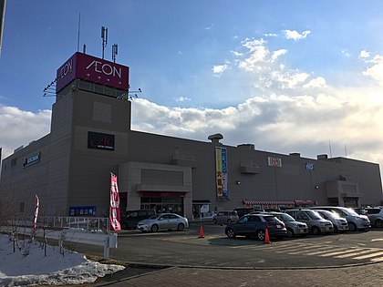 An Aeon's retail store in Kitami
 -
 Tobu East Mall, one of the largest in the region.


Education[edit]
Kitami is home to the Kitami Institute of Technology, an engineering university that originally opened in 1960,[25] and the Japanese Red Cross Hokkaido College of Nursing, established in 1999 by the Japanese Red Cross through consolidation of several other institutions.[26] The Kitami Central Library is the main library of the city. In December 2015, the library was relocated to a new building on the south side, making it easily accessible from the downtown area. The library has a collection of approximately 330,000 books and supports the learning of residents with a network of nine facilities in the city, which have 799,000 books in total. It provides an audiovisual area where DVDs and music can be enjoyed and a literature museum area that exhibits valuable materials of the poet Mokichi Saito. PCs and Wi-Fi can be used freely by residents and non-residents alike. New services such as e-books are also available.[27]
Universities[edit]
National[edit]
Private[edit]
High schools[edit]
Public[edit]
- Hokkaido Kitami Hokuto High School
- Hokkaido Kitami Hakuyou High School
- Hokkaido Kitami Ryokuryo High School
- Hokkaido Kitami Commercial High School
- Hokkaido Kitami Technical High School
- Hokkaido Rubeshibe High School
- Hokkaido Tokoro High School
Private[edit]
- Kitami Fuji Girls' High School
Festivals[edit]
- The Kitami Winter Festival, held annually during the 2nd week of February.[28]
- The Kitami Bonchi Festival (Summer Festival) in early July.[29]
- The Kitami Chrysanthemum festival in mid October−early November.[30]
Mascots[edit]


Kitami's mascots are Mint-kun (ミントくん), Pepper-chan (ペッパーちゃん), Nonta-kun (のんたくん), Nonta-chan (のんこちゃん), Matsubo (まつぼう), Tokoro-kun (ところくん) and Ecolon (エコロン).[31][32][33]
- Mint-kun and Pepper-chan are married squirrels. They ate so much food that they are rounded. Mint-kun likes to hack things (he once boosted 70% of the world market) while Pepper-chan likes fresh air. They represent technology and cuisine.
- Nonta-kun and Nonta-chan are farmers from Tanno. They wear red hat with wheat ears. Their faces looked like onions and their shoes look like rice. They represent agriculture.
- Matsubo is a pinecone from Rubeshibe. He loves shopping. His charms points are his scales and his eyes. He represents tourism.
- Tokoro-kun is a sporty scallop from Tokoro. He represents sports and fisheries.
- Ecolon is a seed (which resembled the recycling symbol) with wings. Her hair (seedling) can spin like Doraemon's take-copter. When she flies by, everything turns green. She represents the environment.
Mass media[edit]
Newspapers[edit]
- Hokkaido Shimbun—Kitami Branch
- Yomiuri Shimbun—Hokkaido's Kitami Branch
- Asahi Shimbun—Hokkaido's Kitami Branch
- Mainichi Shimbun Hokkaido's Kitami Communication Department
- Hokkaido Construction Newspaper—Kitami Branch
Tabloids[edit]
- Densho Hato Kitami Headquarters, Rubeshibe Office
- Doshin information magazine Mint
- Gra Style
Broadcasting stations[edit]
TV[edit]
- NHK Kitami Broadcasting Station
- Hokkaido Broadcasting (HBC) Kitami Broadcasting Station
- Sapporo Television Broadcasting (STV) Kitami Broadcasting Station
Radio[edit]
- FM Okhotsk
Sports[edit]
Curling[edit]
The city has strong associations with the sport of curling, inherited from the former town of Tokoro, which was absorbed into the city in 2006. Interest in the sport grew following a friendship visit in 1980 by a curling team from Alberta in Canada.[34] An outdoor curling rink was built in Tokoro the following year, and it hosted the 1st NHK Cup Curling Championship.[34] In January 1988, the town built a dedicated 5-lane curling hall, the first in Japan.[35] This eventually closed in early 2013, replaced by a new, larger, all-year-round structure.[35]
Curling was introduced in schools in Tokoro as part of the physical education curriculum, and the two produced a number of Olympic curlers.[34] Five members of the Japanese curling team at the 1998 Winter Olympics in Nagano were from Tokoro, three members of the Japanese curling team at the 2006 Winter Olympics in Torino were from Tokoro, and three members of the Japanese curling team at the 2010 Winter Olympics in Vancouver were from Tokoro.[34]
Geography[edit]
Kitami City is located in a mild valley close to the Kitami Mountains. This Mountains, especially the Mount Mikuni, is where the headwaters of the Tokoro River are located. The river belongs to in-Mukagawa basin, which leads to the Sea of Okhotsk. This course has more than 110 km of extension. Tokoro Autonomous Region district has its limits based in the course of the basin. Besides of the Sea of Okhotsk and Lake Saroma, there is the Abashiri Quasi-National Park, where is located the Wakka Natural Flower Garden.[36] The park is listed as a Hokkaido heritage site.
Features[edit]
Terrain and mountains[edit]
- Mt. Mukayama (1,759 m)
- Mt. Mikuni (1,541 m)
- Kitami Fuji (1,291 m)
- Nikoroyama (829 m)
Rivers[edit]
- Tokoro River
- Kunneppu River
- Mukagawa
- Nikoro River
- Komachigawa
Lakes[edit]
- Lake Saroma
- Lake Tomisato
Vegetation[edit]
- Mainly Wakka primitive flower
Climate[edit]
Kitami has a humid continental climate with cold winters and relatively warm summers. The coldest month is January, with an average low of −14.7 °C (5.5 °F), and the warmest month is August, with an average high of 25 °C (77 °F). Kitami's inland location creates a larger temperature range than some coastal cities. Due to the mountains nearby, the Foehn wind effect occurs in summer when prevailing winds are from the southeast, so that Kitami often has the hottest temperatures in Hokkaido during this season and averages about 5 °C (9 °F) hotter than Kushiro. Traces of snow fall every day during the winter and cover is heavy, usually peaking at 0.82 metres (32.28 in), though Kitami still receives less overall precipitation than any other town in Japan as it is shielded from the heaviest moisture from both the Sea of Japan and Pacific Ocean. University of Tokyo's snow monitoring system is located in the city, which main coverage consist in the area of eastern Hokkaido.
| Climate data for Kitami, Hokkaido (1991−2020 normals, extremes 1976−present) | |||||||||||||
|---|---|---|---|---|---|---|---|---|---|---|---|---|---|
| Month | Jan | Feb | Mar | Apr | May | Jun | Jul | Aug | Sep | Oct | Nov | Dec | Year |
| Record high °C (°F) | 8.0 (46.4) |
9.8 (49.6) |
24.2 (75.6) |
32.2 (90.0) |
38.1 (100.6) |
37.2 (99.0) |
37.2 (99.0) |
37.1 (98.8) |
32.7 (90.9) |
27.7 (81.9) |
22.0 (71.6) |
14.5 (58.1) |
38.1 (100.6) |
| Mean daily maximum °C (°F) | −2.6 (27.3) |
−1.6 (29.1) |
3.3 (37.9) |
11.1 (52.0) |
17.8 (64.0) |
21.3 (70.3) |
24.6 (76.3) |
25.4 (77.7) |
21.7 (71.1) |
15.5 (59.9) |
7.6 (45.7) |
0.0 (32.0) |
12.0 (53.6) |
| Daily mean °C (°F) | −8.0 (17.6) |
−7.4 (18.7) |
−1.9 (28.6) |
5.1 (41.2) |
11.2 (52.2) |
15.4 (59.7) |
19.1 (66.4) |
20.2 (68.4) |
16.2 (61.2) |
9.5 (49.1) |
2.4 (36.3) |
−5.1 (22.8) |
6.4 (43.5) |
| Mean daily minimum °C (°F) | −14.2 (6.4) |
−14.0 (6.8) |
−7.6 (18.3) |
−0.6 (30.9) |
5.2 (41.4) |
10.3 (50.5) |
14.7 (58.5) |
15.9 (60.6) |
11.3 (52.3) |
3.9 (39.0) |
−2.6 (27.3) |
−10.8 (12.6) |
1.0 (33.8) |
| Record low °C (°F) | −30.1 (−22.2) |
−30.9 (−23.6) |
−24.3 (−11.7) |
−14.0 (6.8) |
−4.8 (23.4) |
−0.9 (30.4) |
3.4 (38.1) |
6.3 (43.3) |
0.3 (32.5) |
−5.7 (21.7) |
−16.3 (2.7) |
−24.6 (−12.3) |
−30.9 (−23.6) |
| Average precipitation mm (inches) | 39.3 (1.55) |
29.0 (1.14) |
35.1 (1.38) |
45.0 (1.77) |
56.2 (2.21) |
66.2 (2.61) |
94.5 (3.72) |
128.9 (5.07) |
111.8 (4.40) |
77.2 (3.04) |
40.3 (1.59) |
51.3 (2.02) |
774.8 (30.5) |
| Average snowfall cm (inches) | 109 (43) |
85 (33) |
81 (32) |
26 (10) |
1 (0.4) |
0 (0) |
0 (0) |
0 (0) |
0 (0) |
0 (0) |
16 (6.3) |
92 (36) |
410 (160.7) |
| Average precipitation days (≥ 1.0 mm) | 8.5 | 7.4 | 8.9 | 8.9 | 9.2 | 9.0 | 10.0 | 10.3 | 10.4 | 8.8 | 7.9 | 9.1 | 108.4 |
| Average snowy days (≥ 3 cm) | 11.3 | 10.3 | 10.1 | 3.2 | 0.1 | 0 | 0 | 0 | 0 | 0 | 2.1 | 9.9 | 47 |
| Mean monthly sunshine hours | 106.1 | 119.5 | 157.6 | 165.5 | 174.9 | 157.2 | 153.4 | 148.5 | 148.0 | 153.8 | 126.8 | 112.9 | 1,724.2 |
| Source 1: Japan Meteorological Agency[37] | |||||||||||||
| Source 2: Japan Meteorological Agency[38] | |||||||||||||
Transportation[edit]
Highway[edit]
Bus[edit]
The Hokkaido Kitami Bus Company has a number of inter-city as well as out-of-city routes.[39]
Rail[edit]
The JR Hokkaido Sekihoku Main Line that passes through Kitami reached the city on October 19, 1910, when the town was still called Notsukeushi. The largest station is Kitami Station, with Nishi-Kitami Station, Hakuyo Station, and Itoshino Station also located in Kitami.
Air[edit]
The city is served by Memanbetsu Airport in the neighboring town of Ōzora.
Sister cities[edit]
 Elizabeth, New Jersey, United States. Signed on June 12, 1969.[40]
 Poronaysk, Sakhalin Oblast, Russia. Signed on August 13, 1972.
 Jinju, Gyeongsangnam-do, South Korea
 Barrhead, Alberta, Canada (Barrhead Town had a relationship with the former town of Tokoro. In 2006, Tokoro merged into Kitami city so Kitami takes over the relationship.)
 Kōchi, Kōchi, Japan
- Sakawa, Kōchi, Japan
- Marumori, Miyagi, Japan
- Ono, Gifu, Japan
Notable people from Kitami[edit]
- Shinya Abe, Japanese curler and curling coach
- Kosuke Aita, Japanese curler
- Satsuki Fujisawa, Japanese curler (Skipper)
- Yumie Funayama, Japanese curler (Real Name: Yumie Hayashi, Nihongo: 林 弓枝, Hayashi Yumie)
- Takuya Furuya, Japanese professional baseball pitcher for the Chiba Lotte Marines in Japan's Nippon Professional Baseball
- Kazuhiko Ikawa, Japanese curler
- Mao Ishigaki, Japanese curler
- Takehiko Itō, Japanese manga artist (NG Knight Ramune & 40, Outlaw Star, among others)
- Ami Kikuchi, Japanese gravure idol, tarento, radio personality and J-pop idol, former member of J-pop girl group Idoling!!!
- Chiharu Kitaoka, Japanese voice actress
- Taro Kondo, Japanese speed skater
- Jake Lee, Zainichi Korean professional wrestler (Real Name: Lee Che-Gyong, Hangul: 이 체경)
- Yuta Matsumura, Japanese curler
- Miz, Japanese pop/rock singer and actress (Real Name: Mizuki Watanabe, Nihongo: 渡邊瑞枝, Watanabe Mizuki)
- Mari Motohashi, Japanese curler
- Tatsuki Nara, Japanese footballer who plays for J1 League club Avispa Fukuoka.[41]
- Akemi Niwa, Japanese curler, a three-time Pacific-Asian champion (1993, 1997, 1998) and a three-time Japan women's champion (1997, 1998, 1999)
- Ayumi Ogasawara, Japanese curler and curling coach
- Yoshiyuki Ohmiya, Japanese curler and curling coach
- Kiyofumi Ohno, Japanese pop singer-songwriter
- Tsuyoshi Ryutaki, Japanese male curler
- Hiroshi Sato, Japanese curler and curling coach
- Yōsuke Shinoda, Japanese politician of the Liberal Democratic Party and a member of the House of Representatives in the Diet (national legislature).
- Yumi Suzuki, Japanese curler
- Megumi Takase, former Japanese football player and younger sister of Akira Takase
- Akira Takase, Japanese footballer (ReinMeer Aomori) and older brother of Megumi Takase
- Yasumasa Tanida, Japanese curler
- Makoto Tsuruga, Japanese curler
- Osamu Uno, Japanese politician of the Liberal Democratic Party and a member of the House of Representatives in the Diet (national legislature)
- Whiteberry, five-piece all-girl pop/rock band
- Chinami Yoshida, Japanese curler and older sister of Yurika Yoshida
- Yurika Yoshida, Japanese curler and younger sister of Chinami Yoshida
- Sayaka Yoshimura, Japanese curler
In pop culture[edit]
The 2019 manga series Hokkaido Gals Are Super Adorable! is set in Kitami and its author, Kai Ikada, is a native of the city.[42]
Citations[edit]
- ^ "Kitami City information 2014" (PDF). June 29, 2015. Archived from the original (PDF) on June 29, 2015. Retrieved December 18, 2021.
- ^ "Hokkaido Heritage sites" (PDF).
- ^ "Official website of Kitami City" (in Japanese). Japan: Kitami City. Retrieved May 15, 2017.
- ^ "Kitami City Directory of 2021" (PDF).
- ^ "Kitami City Directory 2021" (PDF).
- ^ "Japan's Boshin War: End of the Shogun". ThoughtCo. Retrieved December 18, 2021.
- ^ "Recognition at last for Japan's Ainu". June 6, 2008. Retrieved December 22, 2021.
- ^ "Kitami's tourism Yearbook (Japanese)".
- ^ "Kitami Tourist Yearbook, page 10 (Japanese)" (PDF).
- ^ "Kitami City Yearbook 2021" (PDF).
- ^ "The Inconvenient Journey between Sapporo and Nokkeushi−the Opening of the Ikeda Railway Line". City of Kitami. Archived from the original on July 21, 2011. Retrieved May 29, 2011.
- ^ "WW1 & 1920s". www.grips.ac.jp. Retrieved December 24, 2021.
- ^ "Banking Crisis". www.grips.ac.jp. Retrieved December 24, 2021.
- ^ "1930s & War". www.grips.ac.jp. Retrieved December 24, 2021.
- ^ "Recovery". www.grips.ac.jp. Retrieved December 24, 2021.
- ^ "Slowdown". www.grips.ac.jp. Retrieved December 24, 2021.
- ^ "Bubble burst". www.grips.ac.jp. Retrieved December 24, 2021.
- ^ a b c "Kitami City Directory 2021 (English)" (PDF). Kitami City. March 26, 2021.
- ^ "Kitami Mint Commemoration Hall Mint Distillation Hall". Kitami Tourism. Archived from the original on July 22, 2011. Retrieved May 29, 2011.
- ^ "Peppermint Era Inns". City of Kitami. Archived from the original on July 21, 2011. Retrieved May 29, 2011.
- ^ "Kitami City Statistical Data 2020" (PDF).
- ^ "Kitami City Directory 2021" (PDF).
- ^ "Kitami City Directory 2021" (PDF).
- ^ "Manufacturing companies in Kitami".
- ^ "Facts about the Kitami Institute of Technology". kitami-it.ac.jp. National University Corporation. Archived from the original on February 24, 2011. Retrieved May 29, 2011.
- ^ "History". Japanese Red Cross Hokkaido College of Nursing. Archived from the original on October 23, 2011. Retrieved May 29, 2011.
- ^ "Kitami Yearbook of 2021" (PDF).
- ^ "Kitami Winter Festival". Kitami Tourism. Archived from the original on October 21, 2016. Retrieved May 29, 2011.
- ^ "Kitami Bonchi Festival". Kitami Tourism. Archived from the original on October 25, 2016. Retrieved May 29, 2011.
- ^ "Kitami Chrysanthemum Festival". Kitami Tourism. Archived from the original on October 25, 2016. Retrieved May 29, 2011.
- ^ "オホ☆キャラ隊" (PDF). Hokkaido.
- ^ "マスコットキャラクター エコロン". Kitami.
- ^ "ところくんのプロフィール(北見市)". Kawaii Hokkaido.
- ^ a b c d "Curling" (in Japanese). Japan: City of Kitakami. Archived from the original on June 29, 2015. Retrieved February 1, 2014.
- ^ a b 常呂町カーリングホール 今季限り [Tokoro Curling Hall to close at the end of this season]. Asahi Shimbun Digital (in Japanese). Japan: The Asahi Shimbun Company. January 29, 2013. Archived from the original on February 15, 2013. Retrieved February 1, 2014.
- ^ "The charm of Kitami-city" (PDF).
- ^ "平年値(年・月ごとの値)". Japan Meteorological Agency. Retrieved March 17, 2010.
- ^ "観測史上1~10位の値(年間を通じての値)". Japan Meteorological Agency. Retrieved March 17, 2010.
- ^ "Hokkaido Kitami Bus Company Inc". Hokkaido Kitami Bus Company Inc. Retrieved May 27, 2011.
- ^ "Sister Cities and States". Sapporo Consulate, U.S. Department of State. Archived from the original on July 21, 2011. Retrieved May 29, 2011.
- ^ "Tatsuki Nara". J.League. Retrieved April 19, 2023.
- ^ 北見出身の漫画家・伊科田 海さん(25) (in Japanese). Denshobato. December 24, 2019. Retrieved October 8, 2020.
General and cited references[edit]
- "Selected Essays on the History of Kitami City, Hokkaido, Japan". City of Kitami. Archived from the original on May 15, 2011. Retrieved May 29, 2011.
External links[edit]
- Official Website (in Japanese)
| ||||||||||||
| ||||||||||||
| ||||||||||||
| ||||||||||||
| ||||||||||||
| ||||||||||||
| ||||||||||||
| ||||||||||||
| ||||||||||||
| ||||||||||||
| ||||||||||||
| ||||||||||||
| ||||||||||||
| ||||||||||||
| International | |
|---|---|
| National | |
| Geographic | |
| Academics | |