
Toyohira-ku, Sapporo: Difference between revisions
No edit summary |
ReneeWrites (talk | contribs) m (GR) File:Emblem of Toyohira, Sapporo, Hokkaido.jpg → File:Emblem of Toyohira, Sapporo, Hokkaido.svg |
||
| (24 intermediate revisions by 18 users not shown) | |||
| Line 1: | Line 1: | ||
{{Expand Japanese|date=August 2022}} |
|||
{{Infobox settlement |
{{Infobox settlement |
||
<!-- See Template:Infobox settlement for additional fields and descriptions --> |
<!-- See Template:Infobox settlement for additional fields and descriptions -->| name = Toyohira |
||
| |
| official_name = Toyohira Ward |
||
| |
| native_name = {{nobold|豊平区}} |
||
| |
| native_name_lang = ja |
||
| |
| settlement_type = [[Wards of Japan|Ward]] |
||
<!-- images, nickname, motto -->| image_skyline = ToyohiraKuyakusho2005-1.jpg |
|||
| settlement_type = Ward of Sapporo |
|||
| imagesize = |
|||
<!-- images, nickname, motto --> |
|||
| |
| image_alt = |
||
| |
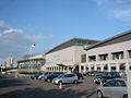
| image_caption = Toyohira ward office |
||
| |
| image_flag = Flag of Toyohira Ward, Sapporo, Hokkaido.svg |
||
| |
| image_seal = Emblem of Toyohira, Sapporo, Hokkaido.svg |
||
| motto = |
| motto = <!-- maps and coordinates --> |
||
| image_map = Location of Toyohira ward Sapporo city Hokkaido Japan.svg |
|||
<!-- maps and coordinates --> |
|||
| |
| map_alt = |
||
| |
| map_caption = <small>Location of Toyohira-ku in [[Sapporo]]</small> |
||
| |
| pushpin_map = Japan |
||
| pushpin_label_position = <!-- position of the pushpin label: left, right, top, bottom, none --> |
|||
| pushpin_map = Japan |
|||
| pushpin_map_alt = |
|||
| pushpin_label_position = <!-- position of the pushpin label: left, right, top, bottom, none --> |
|||
| |
| pushpin_map_caption = Location within Japan |
||
| coordinates = {{coord|43|00|48|N|141|23|28|E|region:JP|display=inline,title}} |
|||
| pushpin_map_caption = Location within Japan |
|||
| coor_pinpoint = <!-- to specify exact location of coordinates (was coor_type) --> |
|||
| latd=43 | latm=00 | lats=48 | latNS=N |
|||
| coordinates_footnotes = <!-- for references: use <ref> tags --> |
|||
| longd=141 | longm=23| longs=28 | longEW= E |
|||
<!-- location -->| subdivision_type = [[List of sovereign states|Country]] |
|||
| coor_pinpoint = <!-- to specify exact location of coordinates (was coor_type) --> |
|||
| subdivision_name = [[Japan]] |
|||
| coordinates_display = inline,title |
|||
| subdivision_type1 = [[List of regions of Japan|Region]] |
|||
| coordinates_footnotes = <!-- for references: use <ref> tags --> |
|||
| subdivision_name1 = [[Hokkaido]] |
|||
<!-- location --> |
|||
| subdivision_type2 = [[Prefectures of Japan|Prefecture]] |
|||
| coordinates_region = JP |
|||
| |
| subdivision_name2 = [[Ishikari Subprefecture|Ishikari]] |
||
<!-- established -->| established_title = <!-- Settled --> |
|||
| subdivision_name = [[Japan]] |
|||
| |
| established_date = April 1, 1972 |
||
<!-- seat, smaller parts -->| seat_type = <!-- defaults to: Seat --> |
|||
| subdivision_name1 = [[Hokkaido]] |
|||
| seat = <!-- government type, leaders --> |
|||
| subdivision_type2 = [[Prefectures of Japan|Prefecture]] |
|||
| government_footnotes = <!-- for references: use <ref> tags --> |
|||
| subdivision_name2 = [[Ishikari Subprefecture|Ishikari]] |
|||
| leader_party = |
|||
<!-- established --> |
|||
| |
| leader_title = |
||
| |
| leader_name = <!-- display settings --> |
||
| total_type = <!-- to set a non-standard label for total area and population rows --> |
|||
<!-- seat, smaller parts --> |
|||
| |
| unit_pref = <!-- enter: Imperial, to display imperial before metric --> |
||
<!-- area -->| area_magnitude = <!-- use only to set a special wikilink --> |
|||
| area_footnotes = <!-- for references: use <ref> tags --> |
|||
<!-- government type, leaders --> |
|||
| area_total_km2 = 46.23 |
|||
| government_footnotes = <!-- for references: use <ref> tags --> |
|||
| |
| area_land_km2 = |
||
| |
| area_water_km2 = |
||
| |
| area_water_percent = |
||
| area_note = <!-- elevation --> |
|||
<!-- display settings --> |
|||
| |
| elevation_footnotes = <!-- for references: use <ref> tags --> |
||
| |
| elevation_m = <!-- population --> |
||
| population_footnotes = <!-- for references: use <ref> tags --> |
|||
<!-- area --> |
|||
| |
| population_total = 224,958 |
||
| |
| population_as_of = August 31, 2021 |
||
| |
| population_density_km2 = auto |
||
| |
| population_note = <!-- time zone(s) --> |
||
| |
| timezone1 = [[Japan Standard Time]] |
||
| |
| utc_offset1 = +9 |
||
| |
| timezone1_DST = |
||
| utc_offset1_DST = <!-- postal codes, area code --> |
|||
<!-- elevation --> |
|||
| postal_code_type = |
|||
| elevation_footnotes = <!-- for references: use <ref> tags --> |
|||
| |
| postal_code = |
||
| area_code_type = <!-- defaults to: Area code(s) --> |
|||
<!-- population --> |
|||
| |
| area_code = <!-- blank fields (section 1) --> |
||
| |
| blank_name_sec1 = Toyohira Ward Office |
||
| |
| blank1_name_sec1 = Postal |
||
| blank1_info_sec1 = 086-8612 |
|||
| population_density_km2 = auto |
|||
| |
| blank2_name_sec1 = Address |
||
| blank2_info_sec1 = 10-1-1 Hiragishi Rokujyo, Toyohira-ku, Sapporo-shi, Hokkaido |
|||
<!-- time zone(s) --> |
|||
| |
| blank3_name_sec1 = Telephone |
||
| |
| blank3_info_sec1 = 011-822-2400 |
||
| |
| blank4_name_sec1 = Symbol of Flower |
||
| |
| blank4_info_sec1 = Tsukubane Asagao |
||
<!-- website, footnotes -->| website = {{URL|www.city.sapporo.jp/toyohira}} |
|||
<!-- postal codes, area code --> |
|||
| |
| footnotes = |
||
| postal_code = |
|||
| area_code_type = <!-- defaults to: Area code(s) --> |
|||
| area_code = |
|||
<!-- blank fields (section 1) --> |
|||
| blank_name_sec1 = Toyohira Ward Office |
|||
| blank1_name_sec1 = Postal |
|||
| blank1_info_sec1 = 086-8612 |
|||
| blank2_name_sec1 = Address |
|||
| blank2_info_sec1 = 10-1-1 Hiragishi Rokujyo, Toyohira-ku, Sapporo-shi, Hokkaido |
|||
| blank3_name_sec1 = Telephone |
|||
| blank3_info_sec1 = 011-822-2400 |
|||
| blank4_name_sec1 = Symbol of Flower |
|||
| blank4_info_sec1 = Tsukubane Asagao |
|||
<!-- website, footnotes --> |
|||
| website = {{URL|www.city.sapporo.jp/toyohira}} |
|||
| footnotes = |
|||
}} |
}} |
||
{{nihongo|'''Toyohira-ku |
{{nihongo|'''Toyohira-ku'''|豊平区}} is one of the 10 wards in [[Sapporo]], [[Hokkaido]], Japan. The ward was established in 1972, when the [[1972 Winter Olympics|Sapporo Olympics]] was held in Sapporo. Four other wards in Sapporo are bounded on Toyohira-ku. |
||
As of April 1, 2012, the ward has an estimated [[population]] of 214,437, with 109,510 [[household]]s and a [[population density]] of 4,626.47 persons per km². The total area is 46.35 km². |
|||
As of April 1, 2012, the ward has an estimated [[population]] of 214,437, with 109,510 [[household]]s and a [[population density]] of 4,626.47 persons per km<sup>2</sup>. The total area is 46.35 km<sup>2</sup>. |
|||
== Overview == |
== Overview == |
||
[[File:SapporoDaigaku2004-9-23.jpg|right|thumb|[[Sapporo University]]]] |
[[File:SapporoDaigaku2004-9-23.jpg|right|thumb|[[Sapporo University]]]] |
||
The name "Toyohira" is derived from Ainu language |
The name "Toyohira" is derived from the Ainu language and means "crumbled cliff".<ref>[http://www.city.sapporo.jp/toyohira/gaiyou/06place_name.html The outline of Toyohira-ku]</ref> The symbol flower of the ward is the [[Petunia]]. The ward has two mascot characters: Korin is a character based on an apple, as apples used to be grown in Toyohira-ku, and Mētan is based on a sheep, which are bred on [[Hitsujigaoka Observation Hill]].<ref>[http://www.city.sapporo.jp/toyohira/machi/character/01about.html Korin and Mētan]</ref> Toyohira-ku has some sports venues which were constructed for the [[1972 Winter Olympics|Sapporo Olympics]] in 1972, and the [[Sapporo Dome]] is also located there. |
||
According to the [[jūminhyō]] (registry of current residential addresses and figures) in 2008, 209,358 people are living in Toyohira-ku, |
According to the [[jūminhyō]] (registry of current residential addresses and figures) in 2008, 209,358 people are living in Toyohira-ku, namely 97,999 males and 111,336 females.<ref>[http://www.city.sapporo.jp/toyohira/gaiyou/02jinkou.html Population of Toyohira-ku]</ref> The total area of the ward is 46.35 km<sup>2</sup>, and it is adjacent to four other wards in Sapporo: [[Minami-ku, Sapporo|Minami-ku]], [[Chūō-ku, Sapporo|Chūō-ku]], [[Kiyota-ku, Sapporo|Kiyota-ku]], and [[Shiroishi-ku, Sapporo|Shiroishi-ku]]. |
||
Toyohira-ku has a number of rivers including the [[Toyohira River]], a tributary of the [[Ishikari River]]. The [[Sapporo University]], [[Hokkai Gakuen University]], and Hokkai School of Commerce are located in Toyohira-ku, as well as a number of high schools, junior high schools, elementary schools and nursery schools. |
Toyohira-ku has a number of rivers including the [[Toyohira River]], a tributary of the [[Ishikari River]]. The [[Sapporo University]], [[Hokkai Gakuen University]], and Hokkai School of Commerce are located in Toyohira-ku, as well as a number of high schools, junior high schools, elementary schools and nursery schools. |
||
== History == |
== History == |
||
In 1857, the railroad from Zenibako area in [[Otaru, Hokkaidō|Otaru]] was laid in the place where Toyohira-ku is currently located. After the [[Meiji Period]], the cultivation in Toyohira-ku was started by pioneers from Honshū, and Hiragishi Village and Tsukisamu Village were formed in 1872, Toyohira Village was established in 1874.<ref name=history>[http://www.city.sapporo.jp/toyohira/gaiyou/05history.html The history of Toyohira-ku]</ref> |
In 1857, the railroad from Zenibako area in [[Otaru, Hokkaidō|Otaru]] was laid in the place where Toyohira-ku is currently located. After the [[Meiji Period]], the cultivation in Toyohira-ku was started by pioneers from Honshū, and Hiragishi Village and Tsukisamu Village were formed in 1872, Toyohira Village was established in 1874.<ref name=history>[http://www.city.sapporo.jp/toyohira/gaiyou/05history.html The history of Toyohira-ku]</ref> |
||
The apple farms were established in Hiragishi Village, which later became famous as the Hiragishi Apple, the [[7th Division (Imperial Japanese Army)|IJA 7th Division]] was posted in Tsukisamu Village, and many stores and hotels were erected along the Route 36. Hiragishi and Tsukisamu villages were merged into Toyohira Village in 1902.<ref name=history/> |
The apple farms were established in Hiragishi Village, which later became famous as the Hiragishi Apple, the [[7th Division (Imperial Japanese Army)|IJA 7th Division]] was posted in Tsukisamu Village, and many stores and hotels were erected along the Route 36. Hiragishi and Tsukisamu villages were merged into Toyohira Village in 1902.<ref name=history/> |
||
In 1908, Toyohira Town was established, and in 1910, Toyohira district in the town was merged into Sapporo district, which was the predecessor of Sapporo City. The entire area of Toyohira Town was merged into Sapporo City in 1961.<ref name=history/> |
In 1908, Toyohira Town was established, and in 1910, Toyohira district in the town was merged into Sapporo district, which was the predecessor of Sapporo City. The entire area of Toyohira Town was merged into Sapporo City in 1961.<ref name=history/> |
||
In 1972, the [[1972 Winter Olympics|Sapporo Olympics]] |
In 1972, the [[1972 Winter Olympics|Sapporo Olympics]] were held in Sapporo, and as Sapporo was listed as one of the [[City designated by government ordinance (Japan)|cities designated by government ordinance]] in the same year, the eastern area of Toyohira Town was split and Toyohira-ku was officially established. In 1997, part of Toyohira-ku was split, and [[Kiyota-ku, Sapporo|Kiyota-ku]] was established. |
||
== Education == |
|||
===Universities=== |
|||
* [[Hokkai Gakuen University]] |
|||
* [[Sapporo University]] |
|||
* [[Hokkai School of Commerce]] |
|||
===Colleges=== |
|||
* Japan Health Care College |
|||
* [[Sapporo University Women's College]] |
|||
===High schools=== |
|||
====Public==== |
|||
* Hokkaido Sapporo Tsukisamu High School (Prefectural) |
|||
* Hokkaido Sapporo Hiragishi High School (Municipal) |
|||
====Private==== |
|||
* Hokkai High School |
|||
* Hokkai Gakuen Sapporo High School |
|||
* Hokkaido Shoshi Gakuen High School |
|||
* Sapporo Daiichi High School |
|||
* Ikegami Gakuen High School |
|||
===International school=== |
|||
* [[Hokkaido International School]] |
|||
==Transportation== |
|||
* [[Sapporo Municipal Subway]] |
|||
** [[Namboku Line (Sapporo)|Namboku Line]]: [[Nakanoshima Station (Hokkaido)|Nakanoshima]] - [[Hiragishi Station (Sapporo)|Hiragishi]] - [[Minami-Hiragishi Station|Minami-Hiragishi]] |
|||
** [[Tōhō Line]]: [[Gakuen-Mae Station (Hokkaido)|Gakuen-Mae]] - [[Toyohira-Kōen Station|Toyohira-Kōen]] - [[Misono Station|Misono]] - [[Tsukisamu-Chūō Station|Tsukisamu-Chūō]] - [[Fukuzumi Station|Fukuzumi]] |
|||
* [[Japan National Route 36|Route 36]] |
|||
== Points of interest == |
== Points of interest == |
||
| Line 119: | Line 136: | ||
File:KITAYELL(1).jpg|Kitayell Arena |
File:KITAYELL(1).jpg|Kitayell Arena |
||
</gallery> |
</gallery> |
||
== Mascots == |
|||
{{multiple image |
|||
| align = left |
|||
| direction = horizontal |
|||
| total_width = 300 |
|||
| footer = Korin and Me-tan, the ward's mascots |
|||
| footer_align = center |
|||
| image1 = Korin.png |
|||
| image2 = Me-tan.png |
|||
}} |
|||
Toyohira's mascots are {{Nihongo|'''Korin'''|こりん}} and {{Nihongo|'''Me-tan'''|めーたん}}. Both worked for the Prefectural Police as detectives.<ref>{{cite web|url=https://www.city.sapporo.jp/toyohira/machi/character.html|title=「こりん」「めーたん」のプロフィール|website=Toyohira}}</ref> |
|||
*Korin is a bright and solid apple who loves to read. She is a good cleaner as she cared about quality. She lives in an apple tree farm. Her dress contains a petunia brooch. |
|||
*Me-tan is an easygoing sheep who eats healthy and play sports. He lives in the Hitsujigaoka Observation Deck. He leaves footprints that can shine light. |
|||
==References== |
==References== |
||
| Line 125: | Line 156: | ||
== External links == |
== External links == |
||
{{commons category|Toyohira-ku, Sapporo}} |
{{commons category|Toyohira-ku, Sapporo}} |
||
* {{Official website|http://www.city.sapporo.jp/toyohira}} {{ |
* {{Official website|http://www.city.sapporo.jp/toyohira}} {{in lang|ja}} |
||
{{Hokkaido}} |
{{Hokkaido}} |
||
{{Authority control}} |
|||
[[Category:Toyohira-ku, Sapporo|*]] |
|||
[[Category:Wards of Sapporo]] |
|||
[[Category:Toyohira-ku, Sapporo| ]] |
|||
[[ko:도요히라 구]] |
|||
[[Category:Wards of Sapporo]] |
|||
[[ja:豊平区]] |
|||
[[uk:Район Тойохіра]] |
|||
[[zh-yue:豐平區]] |
|||
[[zh:豐平區]] |
|||
Latest revision as of 17:48, 15 December 2023
You can help expand this article with text translated from the corresponding article in Japanese. (August 2022) Click [show] for important translation instructions.
|
Toyohira
豊平区 | |
|---|---|
| Toyohira Ward | |
 Toyohira ward office | |
 Flag  Seal | |
 Location of Toyohira-ku in Sapporo | |
 Toyohira Location within Japan | |
| Coordinates: 43°00′48″N 141°23′28″E / 43.01333°N 141.39111°E | |
| Country | Japan |
| Region | Hokkaido |
| Prefecture | Ishikari |
| Area | |
| • Total | 46.23 km2 (17.85 sq mi) |
| Population (August 31, 2021) | |
| • Total | 224,958 |
| • Density | 4,900/km2 (13,000/sq mi) |
| Time zone | UTC+9 (Japan Standard Time) |
| Postal | 086-8612 |
| Address | 10-1-1 Hiragishi Rokujyo, Toyohira-ku, Sapporo-shi, Hokkaido |
| Telephone | 011-822-2400 |
| Symbol of Flower | Tsukubane Asagao |
| Website | www |
Toyohira-ku (豊平区) is one of the 10 wards in Sapporo, Hokkaido, Japan. The ward was established in 1972, when the Sapporo Olympics was held in Sapporo. Four other wards in Sapporo are bounded on Toyohira-ku.
As of April 1, 2012, the ward has an estimated population of 214,437, with 109,510 households and a population density of 4,626.47 persons per km2. The total area is 46.35 km2.
Overview[edit]

The name "Toyohira" is derived from the Ainu language and means "crumbled cliff".[1] The symbol flower of the ward is the Petunia. The ward has two mascot characters: Korin is a character based on an apple, as apples used to be grown in Toyohira-ku, and Mētan is based on a sheep, which are bred on Hitsujigaoka Observation Hill.[2] Toyohira-ku has some sports venues which were constructed for the Sapporo Olympics in 1972, and the Sapporo Dome is also located there.
According to the jūminhyō (registry of current residential addresses and figures) in 2008, 209,358 people are living in Toyohira-ku, namely 97,999 males and 111,336 females.[3] The total area of the ward is 46.35 km2, and it is adjacent to four other wards in Sapporo: Minami-ku, Chūō-ku, Kiyota-ku, and Shiroishi-ku.
Toyohira-ku has a number of rivers including the Toyohira River, a tributary of the Ishikari River. The Sapporo University, Hokkai Gakuen University, and Hokkai School of Commerce are located in Toyohira-ku, as well as a number of high schools, junior high schools, elementary schools and nursery schools.
History[edit]
In 1857, the railroad from Zenibako area in Otaru was laid in the place where Toyohira-ku is currently located. After the Meiji Period, the cultivation in Toyohira-ku was started by pioneers from Honshū, and Hiragishi Village and Tsukisamu Village were formed in 1872, Toyohira Village was established in 1874.[4]
The apple farms were established in Hiragishi Village, which later became famous as the Hiragishi Apple, the IJA 7th Division was posted in Tsukisamu Village, and many stores and hotels were erected along the Route 36. Hiragishi and Tsukisamu villages were merged into Toyohira Village in 1902.[4]
In 1908, Toyohira Town was established, and in 1910, Toyohira district in the town was merged into Sapporo district, which was the predecessor of Sapporo City. The entire area of Toyohira Town was merged into Sapporo City in 1961.[4]
In 1972, the Sapporo Olympics were held in Sapporo, and as Sapporo was listed as one of the cities designated by government ordinance in the same year, the eastern area of Toyohira Town was split and Toyohira-ku was officially established. In 1997, part of Toyohira-ku was split, and Kiyota-ku was established.
Education[edit]
Universities[edit]
Colleges[edit]
- Japan Health Care College
- Sapporo University Women's College
High schools[edit]
Public[edit]
- Hokkaido Sapporo Tsukisamu High School (Prefectural)
- Hokkaido Sapporo Hiragishi High School (Municipal)
Private[edit]
- Hokkai High School
- Hokkai Gakuen Sapporo High School
- Hokkaido Shoshi Gakuen High School
- Sapporo Daiichi High School
- Ikegami Gakuen High School
International school[edit]
Transportation[edit]
Points of interest[edit]
- Sapporo Dome - a stadium which is the home field of the Hokkaido Nippon-Ham Fighters baseball team, and Consadole Sapporo football club
- Hitsujigaoka Observation Hill - where visitors can view the scene of Sapporo City from the hill, also famous for the bronze statue of William S. Clark
- Tsukisamu Dome - one of the events and sports venues in Sapporo
- Hokkaido Prefectural Sports Center (Kitayell) - an indoor sporting arena
- Tsukisamu Gymnasium - an indoor ice arena
-
 Sapporo Dome
 -
 Kitayell Arena

.jpg)
Mascots[edit]


Toyohira's mascots are Korin (こりん) and Me-tan (めーたん). Both worked for the Prefectural Police as detectives.[5]
- Korin is a bright and solid apple who loves to read. She is a good cleaner as she cared about quality. She lives in an apple tree farm. Her dress contains a petunia brooch.
- Me-tan is an easygoing sheep who eats healthy and play sports. He lives in the Hitsujigaoka Observation Deck. He leaves footprints that can shine light.
References[edit]
External links[edit]
- Official website (in Japanese)
| ||||||||||||
| ||||||||||||
| ||||||||||||
| ||||||||||||
| ||||||||||||
| ||||||||||||
| ||||||||||||
| ||||||||||||
| ||||||||||||
| ||||||||||||
| ||||||||||||
| ||||||||||||
| ||||||||||||
| ||||||||||||
| International | |
|---|---|
| National | |
| Geographic | |